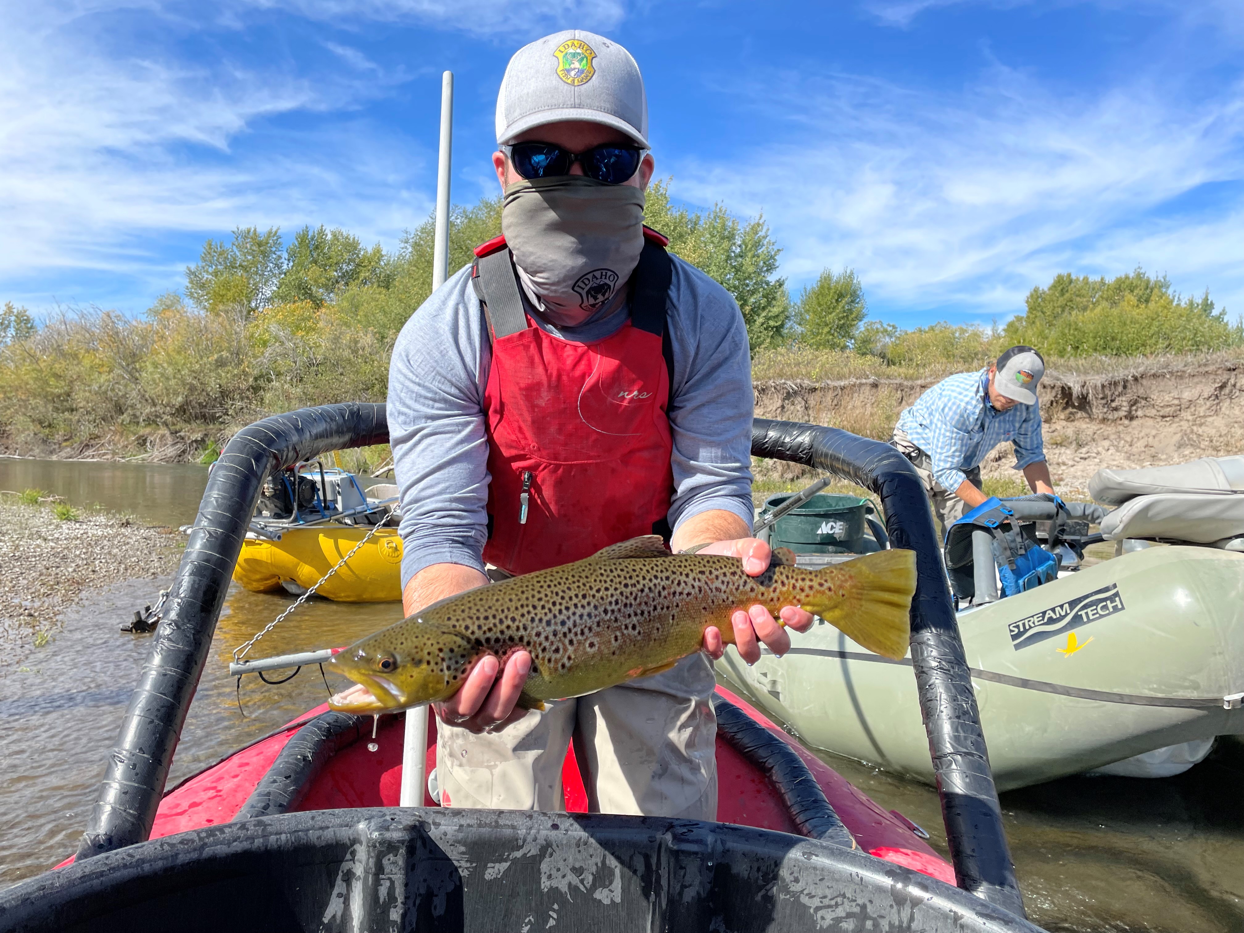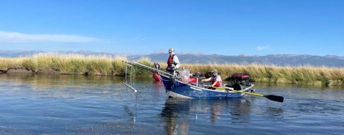
Throughout the month of September 2021 rafts outfitted with electrofishing gear could be seen shocking fish in the Teton River Valley and the South Fork Teton River near Rexburg. The Idaho Department of Fish and Game (IDFG) along with staff and volunteers with the Friends of the Teton River conducted fish population surveys using mark/recapture methods on three monitoring reaches in the Teton River drainage. The two monitoring reaches in the Teton River Valley are conducted every other year while the South Fork Teton survey has been monitored periodically. These surveys provide valuable information to track populations through time, which is especially informational after this summer when we’ve experienced low flows and high water temperatures in the Teton River. Results from these monitoring surveys help guide fisheries management decisions. You can review the current fishing regulations for an example of one of these management decisions. For example, the daily bag limit for Rainbow Trout in the Teton River was recently changed to an unlimited daily harvest amount in response to increasing numbers of Rainbow Trout in the river. As managers, we hope to use increased harvest of this non-native trout to benefit the native Yellowstone Cutthroat Trout population still residing in the Teton River. Counting fish numbers at specific locations at regular intervals allows IDFG to track changes in the populations through time, which is valuable for making informed management decisions.
The two monitoring sites in Teton River Valley were the Nickerson and Breckenridge monitoring reaches. The Nickerson reach begins just downstream from the confluence of Teton Creek and ends 3.45 miles further down river while the Breckenridge reach begins at the Packsaddle/Cache Bridge and continues 3.06 miles downstream. The following is a preliminary summary of the results from these surveys.
Nickerson Reach
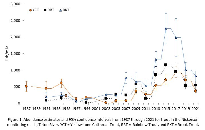
The Nickerson monitoring reach is home to Yellowstone Cutthroat, Rainbow, and Brook Trout. During the 2021 survey, we estimate there are 370 Yellowstone Cutthroat Trout (YCT)/mile which is lower than both our 2019 estimate of 697 YCT/mile and the ten year average of 383 YCT/mile (Figure 1). Brook Trout (BKT) abundances have been on a downward trend since 2015 to an estimate of 828 BKT/mile this year which is below our ten year average of 917 BKT/mile. Rainbow Trout (RBT) abundance estimates have slightly increased since our 2019 estimate of 526 RBT/mile to 543 RBT/mile in 2021, and is currently above the ten year average of 487 RBT/mile. Total trout abundance in the Nickerson Reach during the 2021 was not significantly different that total trout abundance from 2019 indicating total trout were not significantly impacted by low water levels and increased water temperatures this summer.
Breckenridge Reach
We have been monitoring the Yellowstone Cutthroat, Rainbow, Brook, and Brown trout populations in this monitoring reach. The abundance of YCT in this reach has remained similar to our estimates conducted over the last nine survey years (Figure 2). This year we estimated there are 56 YCT/mile which is higher than the 10 year average of 41 YCT/mile. Rainbow Trout abundance has decreased over the last 4 surveys to the 2021 estimate of 648 RBT/mile, which is lower than the ten year average of 909 RBT/mile. The Brook Trout abundance estimate of 459 BKT/mile is lower than our 2019 estimate of 673 BKT/mile but slightly higher than the ten year average of 426 BKT/mile. Brown Trout were first observed in the Breckenridge reach in 2007. Between 2007 and 2013, we captured low numbers (one to seven fish) of Brown Trout in our surveys. Since 2013, Brown Trout (BNT) catches have increased to 28, 32, 145, and 165 during our 2015, 2017, 2019, and 2021 surveys, respectively. The 2019 survey was the first time we captured enough BNT to generate an abundance estimate. The 2019 estimate was slightly lower at 177 BNT/mile than our 2021 estimate of 192 BNT/mile, but not statistically different. Total trout abundance was similar between the 2019 and 2021 surveys and showed no significance difference between these two years despite low water and high water temperatures present this past summer.


South Fork Teton River
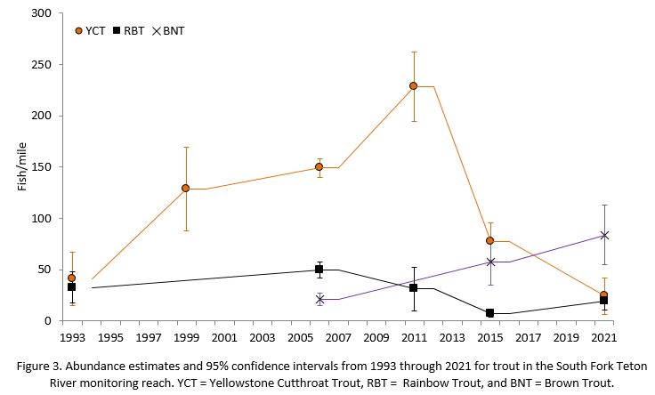
A survey was also conducted on the South Fork of the Teton monitoring reach in 2021. This reach begins near the Orange Bridge by Rexburg and ends near the confluence of the South Fork of the Teton River and the Henrys Fork of the Snake River. This stretch of river has been periodically sampled since 1993 with the last survey occurring in 2015. Total trout abundance was similar between the 2015 and 2021 surveys at 152 and 161 trout/mile, respectively. The most prevalent species of trout captured during this survey was Brown Trout and we estimated their abundance at 84 Brown Trout per mile (Figure 3). Our 2021 estimate for Rainbow Trout is slightly higher than our 2015 estimate at 19 RBT/mile compared to 7 RBT/mile, respectively. Yellowstone Cutthroat Trout abundance show a decreasing trend over the last two surveys to an estimate of 24 YCT/mile.
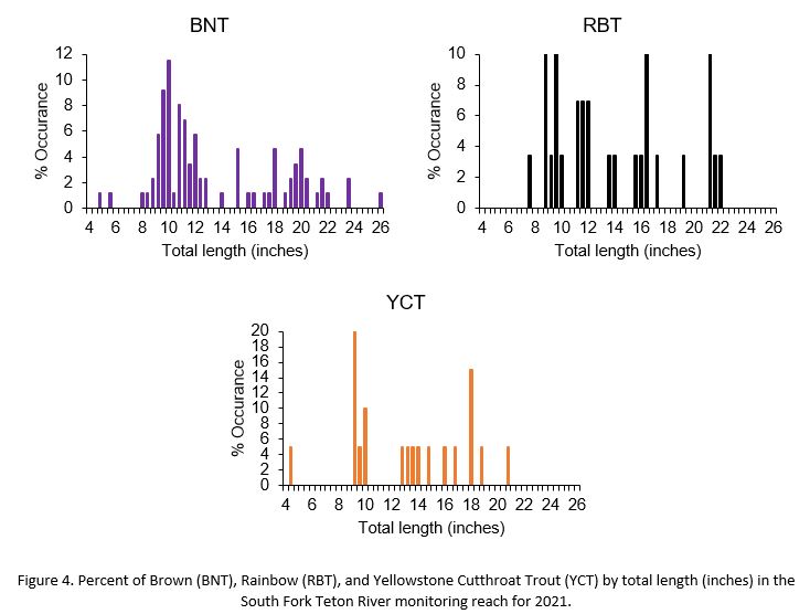
Although large abundances of trout are not present in this reach of the river, we captured trout across a wide range of sizes and a number of large trout. We captured some sizeable trout with 26% of the BNT, 21% RBT, and 25% of the YCT catch greater than 18 inches (Figure 4).