
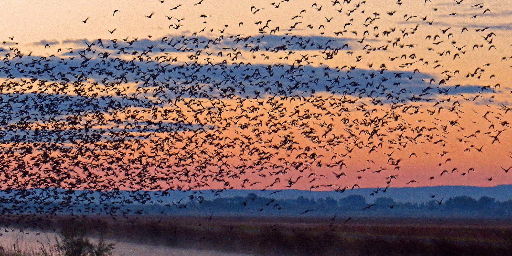
The Snake River has received much acclaim as the go-to public land duck hunting destination in Idaho, but it’s certainly not the only place where hunters have an accessible place to hunt waterfowl. About two-thirds of Fish and Game's Wildlife Management Areas are managed with waterfowl in mind, providing food and resting areas for migrating waterfowl.
Fish and Game has 31 WMAs throughout the state, 20 of which can provide good-to-great waterfowl hunting when conditions are right. These WMAs vary greatly in size and are spread out through five of Fish and Game’s seven regions, including the Panhandle, Southwest, Magic Valley, Southeast, and Upper Snake. Most of them have options for quality walk-in access, and portions can be hunted successfully with limited decoys and without a dog.
WMA waterfowl hunting: The big picture
Waterfowl abundance is generally dependent upon weather patterns, and timing of the fall and winter migrations. Because WMAs are so geographically varied, hunting opportunities differ from region to region, and even between WMAs within a region.
As a general rule, WMAs in the northern and eastern part of the state tend to have shorter windows for waterfowl hunting due to an earlier freeze-up, and most of the hunting takes place prior to Thanksgiving. After that, most waterfowl shift to rivers that don't freeze, or freeze later. Waterfowl congregating in those areas often migrate out when temperatures get frigid and the birds move on to warmer climates inside and beyond Idaho. Waterfowl hunters in the Panhandle and Upper Snake regions should know that grizzly bears are active in the fall during the early part of the waterfowl season, and should take precautions and be "bear aware."
WMAs in southern Idaho tend to have longer windows for waterfowl hunting, and many can be hunted throughout the season, depending on local conditions.
Here is a look at the WMAs available to waterfowl hunters. Follow the links for a more in-depth information about each individual WMA, along with maps and other important information.
Keep in mind that the acreages listed for the Wildlife Management Areas encompass the whole WMA, not just the portions suitable for waterfowl hunting. Wetland areas are typically a fraction of the total acreage, and waterfowl hunting on Fish and Game's WMAs is a popular activity – meaning many of these see high usage during duck season, particularly on weekends and holidays. Don't expect to be alone at any particular WMA, and expect competition from other hunters for prime hunting spots.
Hunters should also keep in mind that much of the waterfowl season overlaps with pheasant season, and many of WMAs are also popular pheasant hunting destinations. Fish and Game stocks pheasants at more than half of the WMAs listed below, and there are special rules for pheasant hunters on those properties, including a 10 a.m. start time for shooting hours.
Duck hunters on these properties will often find less competition, and the best waterfowl hunting, before 10 a.m. If duck hunters are planning on pheasant hunting as well, they need to follow those rules, and also not be in possession of shotgun shells containing lead shot while they are waterfowl hunting.
Before hunters head out, they should check out the current Idaho Migratory Game Bird Seasons and Rules brochure and remember that they are required to possess/use:
- A valid Idaho hunting license or hunting passport
- Migratory Bird (HIP) Permit
- Federal Migratory Bird (Duck) Stamp for all hunters 16 years or older
- Nontoxic shot
Jump to section
Panhandle Region
Boundary-Smith Creek WMA — 2,072 acres
Boundary-Smith Creek WMA hugs the Canadian border in the northernmost part of Idaho.
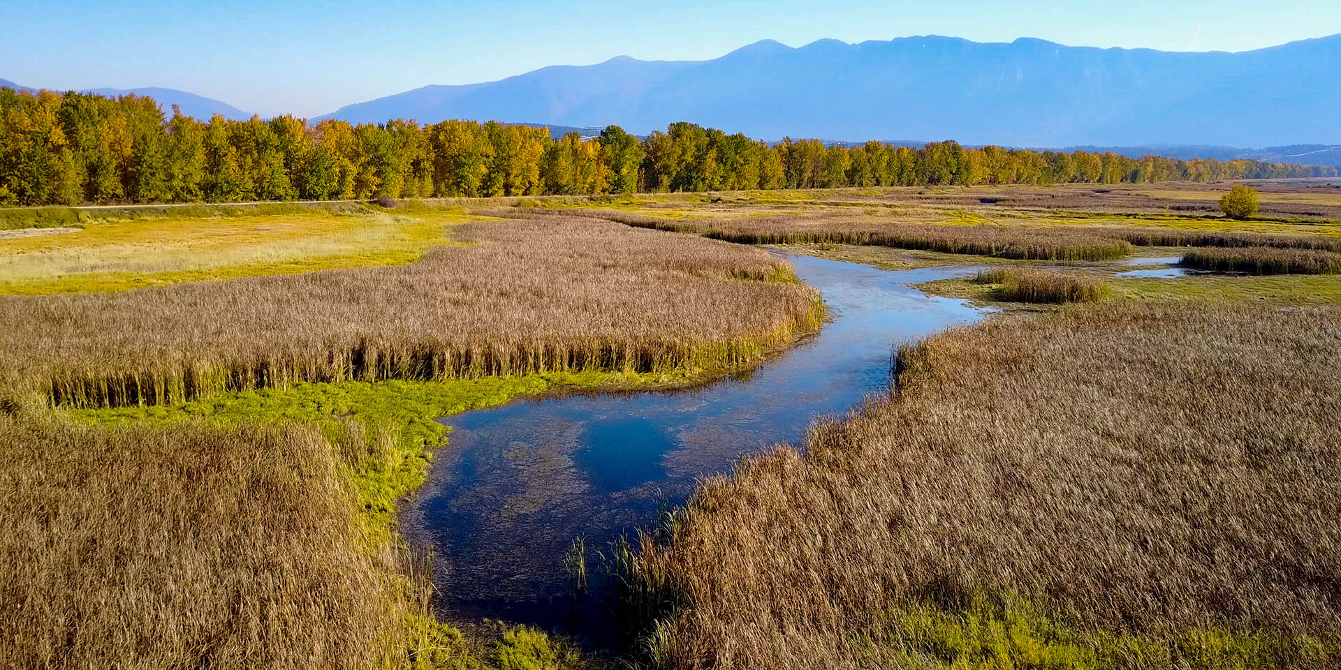
Restored wetlands and floodplain habitats support a broad range of wildlife, and provides both shallow and deep-water habitats necessary for dabbling and diving ducks. Up to 6,000 migrating waterfowl visit this WMA each spring and fall. Hunting here can be quite good until things freeze, usually around Thanksgiving.
McArthur Lake WMA — 1,891 acres
The WMA sits at the narrowest point of the valley between the Selkirk and Cabinet Mountain ranges.

McArthur Lake is one of the oldest WMAs to specifically protect and enhance waterfowl habitat. It provides breeding and nesting habitat for 17 waterfowl species. During the spring and fall migrations, large numbers of ducks, geese, tundra swans, and shorebirds use McArthur Lake as a stopover and resting location. As with Boundary-Smith Creek WMA, hunting can be very good until the lake freezes up, usually in mid-November.
Pend Oreille WMA — 7,432 acres
The WMA consists of 25 parcels of land scattered along the edges of Lake Pend Oreille, the Pend Oreille River, Pack River, Clark Fork Delta, Priest River and additional nearby waters.
The parcels range from 2 acres to 1,729 acres. Pend Oreille WMA properties provide habitat for migrating and wintering waterfowl. Sites that typically support thousands of waterfowl during migration include Morton Slough, Oden Bay, the Pack River Delta, Denton Slough and the Clark Fork River Delta.
The greatest waterfowl use of the WMA occurs in the fall. Maximum waterfowl counts usually occur in November and December. Waterfowl numbers have been as high as 60,000 ducks, 15,000 Canada geese, and 2,000 tundra swans. Diving ducks are especially numerous on the deeper bays, primarily redheads, scaup, and ring-necked ducks. A large portion of the Pacific Flyway’s redhead duck population winters on Lake Pend Oreille, and redhead counts have reached 20,000 ducks.
Hunting can be excellent for ducks and geese early in the season before Lake Pend Oreille is drawn down to its winter levels. The drawdown typically starts in October and the lake reaches winter pool levels by mid-November. As the lake is lowered, near-shore access areas are dewatered, mudflats appear, and hunting becomes more difficult.
Coeur d’Alene River WMA — 8,638 acres
This WMA is largely a mix of wetland habitats and small lakes, composed of a collection of land parcels along the river between Harrison and Cataldo. Additional parcels are scattered around the lake and along the St. Joe and St. Maries rivers.
Thousands of birds, including tundra swans, descend on its waters to rest and feed during their seasonal migrations. A significant portion of the waterfowl hunting in northern Idaho occurs on the WMA each fall.
Hunting is excellent for ducks early in the season. If the weather is mild, good hunting for ducks and Canada geese continues through November. Migrating mallards stop at areas with wild rice, utilizing it as a principal food source.
Some walk-in access is available, but having a boat opens up far more terrain to hunt.
Jump to section
Southwest Region
Payette River WMA -- 1,066 acres
This WMA consists of scattered parcels on the Payette and Snake rivers, which includes a total of under 100 acres of ponds, along with islands in the Payette River that are popular with waterfowl hunters. The hunting on the river islands, and the WMA in general, tends to heat up when other water in the area freezes. Canada geese and mallards are the most common species, but other waterfowl including wood ducks, gadwall, widgeon, green-winged teal and common goldeneye are also found here.
The WMA includes three main sections – Birding Islands, Emmett segment, and Little Banks Island. Public parking lots and boat launches are available, but the WMA is closed to vehicle traffic and only allows only foot or boat travel.
The Birding Islands segment lies approximately 9 miles east of the town of Payette. It includes several islands in the Payette River and adjacent sites on the mainland, along with nine waterfowl production ponds that are open to hunters during the season. The ponds are accessible to walk-in hunters, as are sites on the mainland, and a many of the islands can be accessed through wadeable portions of the river. Some water is shallow enough to retrieve ducks in waders, but a dog is needed in others.
The Emmett Segment is a 200 acre piece located approximately 3 miles west of Emmett, Idaho, on the Payette River. This section includes a group of scattered islands, with good sloughs and side channels to hunt on, making it a highly used waterfowl production area. Hunters will need a boat -- a kayak or canoe will do -- to access the popular inner islands, but there are a couple spots where hunters can set up on the main bank.
The 21-acre Little Banks Island segment is located in the Snake River, about one mile south of the confluence of the Snake and Payette Rivers, and provides hunter access and waterfowl production habitat. You'll need a watercraft capable of safely navigating the Snake River to access this parcel.
Montour WMA — 1,350 acres
Montour WMA is located along the Payette River in the Montour Valley in Gem County, 9 miles east of Horseshoe Bend and Highway 55 and one mile South of Highway 52.
Natural and created wetlands and ponds within the WMA provide food, cover, nesting, and resting habitat for waterfowl.
Fish and Game, in cooperation with the Bureau of Reclamation, constructed five waterfowl production ponds on the WMA totaling about 48 acres. The Payette River provides open water for wintering waterfowl during the colder periods when all nearby ponds, marshes and other waters are frozen. Waterfowl hunting can be good, both in the ponds and along the river, depending on the weather conditions, but space on the ponds is fairly limited.
A word of caution for waterfowl hunters: while the ponds appear shallow, half of the water is between three and five feet deep, and the bottom can be soft. You may need a boat to hunt the inner islands on the ponds. Even if you're hunting from the outer banks and have a pair of chest waders, retrieving birds yourself can get a little dicey. If you don't have a duck dog (or a wind to push ducks closer to the bank), you may want to look elsewhere.
Fort Boise WMA -- 1,209 acres
Fort Boise WMA is located five miles northwest of Parma in Canyon County, and includes wetland, riparian and upland habitat on the north bank of the Boise River at the confluence with the Snake River. Also encompassed in the WMA is the 330-acre Gold Island, in the Snake River.
Shallow water and thick riparian vegetation make Fort Boise and the nearby 680-acre Roswell Marsh Wildlife Habitat Area waterfowl havens. Both areas provide nesting and winter habitat for waterfowl, and important habitat for migrating birds like snow geese and white-fronted geese. Mallards and gadwall are common waterfowl nesting species, and Canada geese, goldeneyes, widgeon, northern pintails and wood ducks can also be found here.
Walk-in access opportunities on Fort Boise include nine waterfowl ponds that are open during the hunting season, as well as bank access to the Boise and Snake Rivers. Hunters will need a watercraft capable of safely navigating the Snake River to access Gold Island.
Roswell is divided into two sections -- a marsh and an upland portion. Most waterfowl opportunity is limited to the 200 acre marsh portion, and all of it is walk-in access only. The marsh portion is open for hunting Thursdays, Fridays and Saturdays only. The ponds are relatively small so space is limited for hunters.
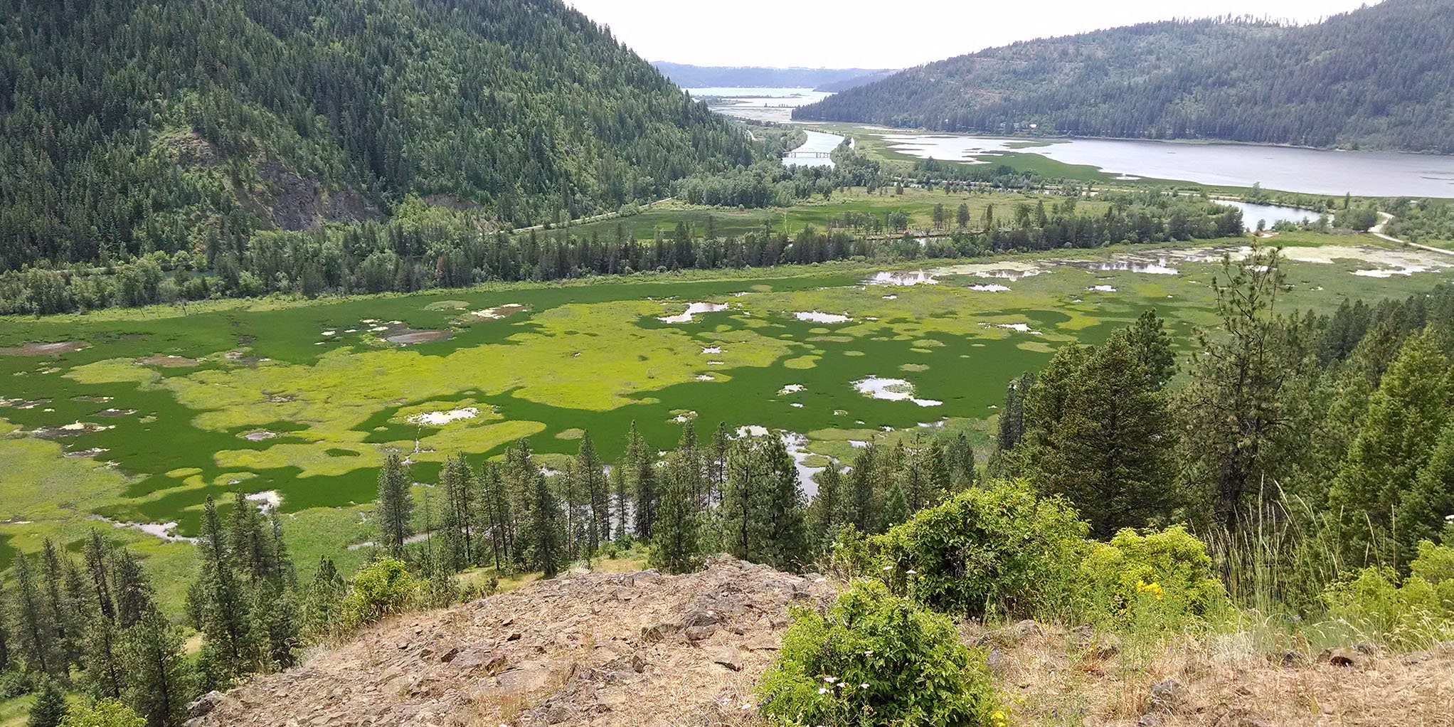
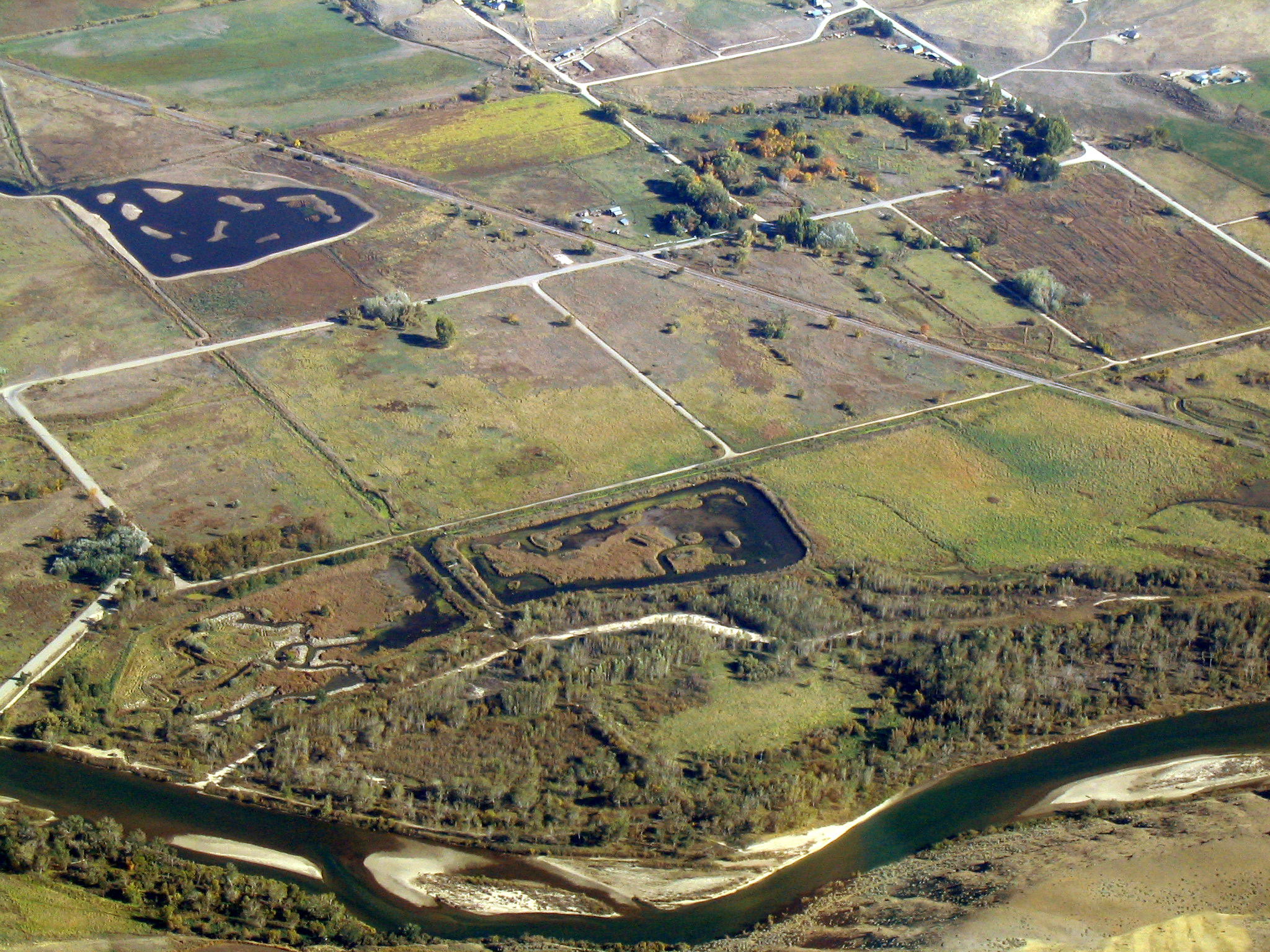
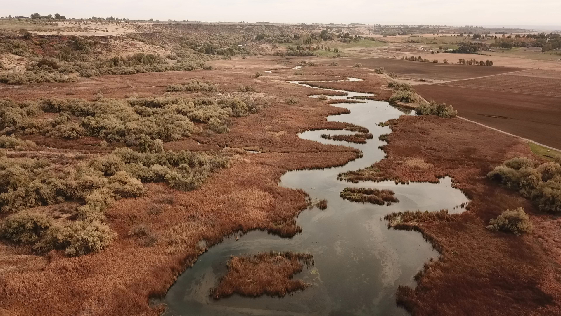
C.J. Strike WMA -- 11,008 acres
C.J. Strike Wildlife Management Area is an important stop-over location for waterfowl during spring and fall migrations, providing critical food for ducks and geese migrating to nesting or wintering grounds, as well as an excellent hunting opportunity for waterfowlers. Recent improvements at the WMA have improved waterfowl habitat and opportunities for hunters.
This huge WMA is located along the Snake and Bruneau Rivers south of Mountain Home. In addition to wetlands, rivers, and the large reservoir, the lands adjacent to the WMA are made up of agricultural fields and irrigated pasture, making C.J. Strike WMA an ideal location for waterfowl. The area typically holds 30,000 to 80,000 ducks and geese throughout the season.
The majority of the harvest in this area consists of mallards and Canada geese, although other waterfowl species routinely show up in the harvest; American wigeon, northern pintail, American green-winged teal, gadwall, and wood ducks. There is also opportunity to harvest goldeneye (Barrow’s and common), and other diving ducks, although these species typically prefer the Snake River.
Weather typically begins to turn cold during mid-November and decent numbers of ducks and geese start arriving. However, quality hunting can be had for those willing to scout throughout the season.
The WMA is divided into seven management segments, each of which has different habitat. Here is a more detailed look at some of the hunting opportunities available in those segments. Hunters should be prepared to pack in good distances because there are few roads open to access the interior, but there are numerous parking lots spread throughout the WMA, as well as boat launches.
Jump to section
Magic Valley Region
Carey Lake WMA -- 750 acres
Carey Lake WMA is less than a mile east of the town of Carey. The shallow lake and surrounding wetlands attract a variety of waterfowl, and is a popular early season destination for waterfowl hunters prior to the freeze-up, which typically occurs around mid-November. Ducks tend to clear out of the area earlier, while geese will stick around a little later.
At around 4,700 feet elevation, Carey Lake frequently has frigid temperatures by late fall, so the window for waterfowl hunting is short. The WMA has a parking area and few amenities.
The north end of the lake is fairly deep – up to 12 feet in spots – but 80 percent of the lake is less than three feet deep, with the best walk-in opportunity and aquatic vegetation located on the south end. While shallow, the muddy bottom of Carey Lake can make for tougher walking, so chest waders are a must and retrieving birds is made easier with a dog or a small boat like a canoe or kayak, which hunters would have to carry in a quarter-mile from the parking lot.
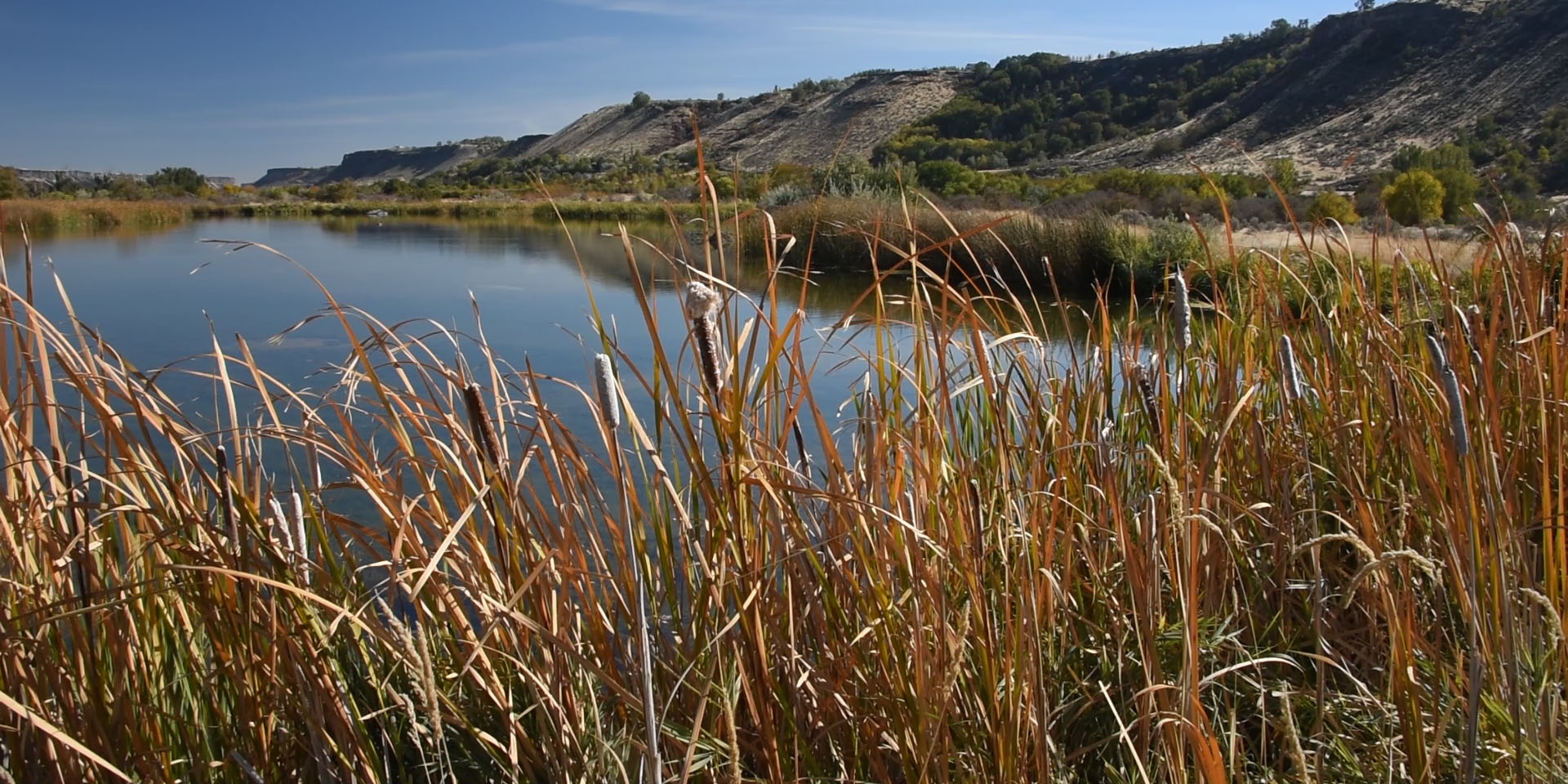
Billingsley Creek WMA -- 275 acres
Billingsley Creek WMA lies below the volcanic rim of the Snake River Plain in the Hagerman Valley, about 1.5 miles northeast of Hagerman. Billingsley Creek, the centerpiece of the WMA, provides open water to wintering waterfowl. The creek is fed by seven springs that originate along the basalt rim rock, which keeps the creek mostly ice-free during the winter.
Waterfowl hunting is best when surrounding slack-waters in the Hagerman Valley freeze. During these peak periods of waterfowl hunting activity on the WMA, hunter congestion can be a problem, especially along the more popular waterfowl hunting areas on Billingsley Creek.
This 1.5 mile stretch of moving water provides small-water hunting opportunity, mostly for dabbling ducks like mallards, gadwall, widgeon and teal. While some of the wetland areas surrounding the creek are wadeable, the creek itself is deep, and the vegetation surrounding it is mostly tall tules. Those conditions make finding and retrieving birds difficult, if not impossible, without a dog. A small boat, like a canoe or kayak, is also a plus, helping hunters reach more desirable hunting spots on the creek, but they will have to carry it in from one of three parking areas to launch. Hunters at Billingsley Creek need to be aware that the WMA borders a state park where no hunting is allowed, so they should be mindful of the boundary on the south side.
Camas Prairie-Centennial Marsh WMA
Centennial Marsh is located 14 miles west of Fairfield near Idaho 20. The WMA is a high prairie, seasonally-flooded wetland.
In the spring, as snow melt and runoff water enter the gently sloping valley floodplain, it spreads out creating temporary wetlands. The western end of the valley is inundated with water for as much as four months. The flows of Camas Creek generally stop about mid-July and the marsh waters gradually recede. Near the end of October or early November, Camas Creek starts flowing again, and in rare years, it floods the marsh during fall, but to a lesser degree than during spring.
When there is water there in the fall, Centennial Marsh is strictly an early season destination for waterfowl hunters. Waterfowl hunting opportunities are limited not just by the rare reflooding events, but also when freeze up occurs, which typically starts by early to mid-November. Then the marsh stays snow covered until mid-April, so there is a short window of opportunity to hunt.
Niagara Springs WMA -- 976 acres
Located 6.5 miles south of Wendell along the north bank of the Snake River. The Snake River and the multiple developed ponds coupled with annual and perennial food plots attract a multitude of waterfowl.
Ducks and geese use the WMA year round with the heaviest use during fall and winter. The multiple ponds and open waters of the flowing ditches are utilized by waterfowl as a resting and loafing area as they migrate south. The uplands adjacent to these waters are utilized by resident waterfowl for nesting in the spring. The ponds, ditches, and Snake River then provide the important brood-rearing habitat in late spring and summer.
The WMA also provides access to 3.5 miles of the Snake River, which gets the most use from waterfowl hunters. The river portion of the WMA provides season-long opportunity. Hunters on the river would be wise to bring a dog to avoid losing downed birds in the current.
There are also four ponds on the WMA that get some waterfowl and hunter use, one of which has a waterfowl hunting and viewing blind that is available on a first-come, first-served basis. Most waterfowl hunting opportunity at Niagara Springs can be accessed by foot with waders, and there is vehicle access to multiple parking areas on the western portion of the WMA that are open in the fall.
Jump to section
Southeast Region
Sterling WMA -- 4,106 acres
The WMA is located in Bingham County about four miles northeast of Aberdeen and 25 miles southwest of Blackfoot. The WMA is adjacent to the west side of American Falls Reservoir and is separated into three sections. The WMA rests in the middle of farm country. Its wetlands support breeding and migrating waterfowl. The area is a mixture of uplands, marshes, meadows, open water, agricultural lands, and Russian olives.
Numerous developments have been created to improve the area for wildlife. Wetland projects included pond excavations, potholes, water control structure maintenance, and most recently, rerouting streams to create additional wetlands.
The diversity of vegetation and water provides a unique situation in which to manage for wildlife habitat and hunting opportunity. The WMA's proximity to Pocatello and the great upland habitat found here makes Sterling a more popular pheasant destination than a waterfowl destination, good early season opportunity is still available for waterfowl hunters, typically through mid-November. Various species of dabbling and diving ducks can be found on the WMA, including mallards, Canada geese, northern pintails, and widgeon.
Access for waterfowl hunting is entirely walk-in. A wildlife blind for youth and ADA hunters is available on a first-come, first-served basis. The blind is also available for wildlife viewing. The WMA surrounds two parcels of private of land. Landowners permit public access and hunting; WMA rules apply to these two properties. Some of the harder-to-reach spots are popular.
Blackfoot River WMA -- 2,400 acres
The WMA is located in Caribou County 16 miles northeast of Soda Springs, and is bisected by the headwaters of the Blackfoot River. The WMA includes the first 7 miles of the Blackfoot River, formed by the confluence of Diamond Creek, Lanes Creek, and several small tributaries at the east edge of the WMA. Gentle flows, backwaters, wet meadows, and adjacent shrublands provide rearing and nesting habitat for a variety of waterfowl.
Waterfowl hunting opportunity for Canada goose and mallard can be decent, at least through mid-November, but the hunting area is limited to the river itself. The river can be difficult to float for waterfowl hunters, because it is shallow and slow moving, but that also makes it easy for hunters to wade. Although hunters could hunt over decoys, the WMA mostly offers jump shooting opportunities. Hunters without a dog can retrieve birds if they have chest waders. It's worth mentioning that there are no substantial food sources for waterfowl -- fields or grains -- in the area, so the WMA is more sensitive to hunting pressure than others.
Georgetown Summit WMA -- 4,353 acres
This WMA is located in Bear Lake County 12 miles southeast of Soda Springs. Although primarily established to protect elk and deer winter habitat, the WMA can also provide solid early-season waterfowl hunting opportunity, before the freeze-up in mid-November.
Opportunities can be found on the roughly 3.5 miles of the Bear River, which meanders through the south edge of the WMA and offers habitat for waterfowl. The river includes a couple of islands and bank access, but the water is deep enough to make a boat and a dog necessary.
Portions of the WMA's river corridor are in agricultural production. The rotation includes grain fields and alfalfa, which provides food for waterfowl and dry-land opportunities for hunters. There are several trailheads along the river that allow hunters to access the farmed land. In a given year, about 10 percent of the farmed land is planted in grains. Hunters should be aware that the farmland is in an agricultural rotation, so the grain fields are constantly moving every couple years.
Jump to section
Upper Snake Region
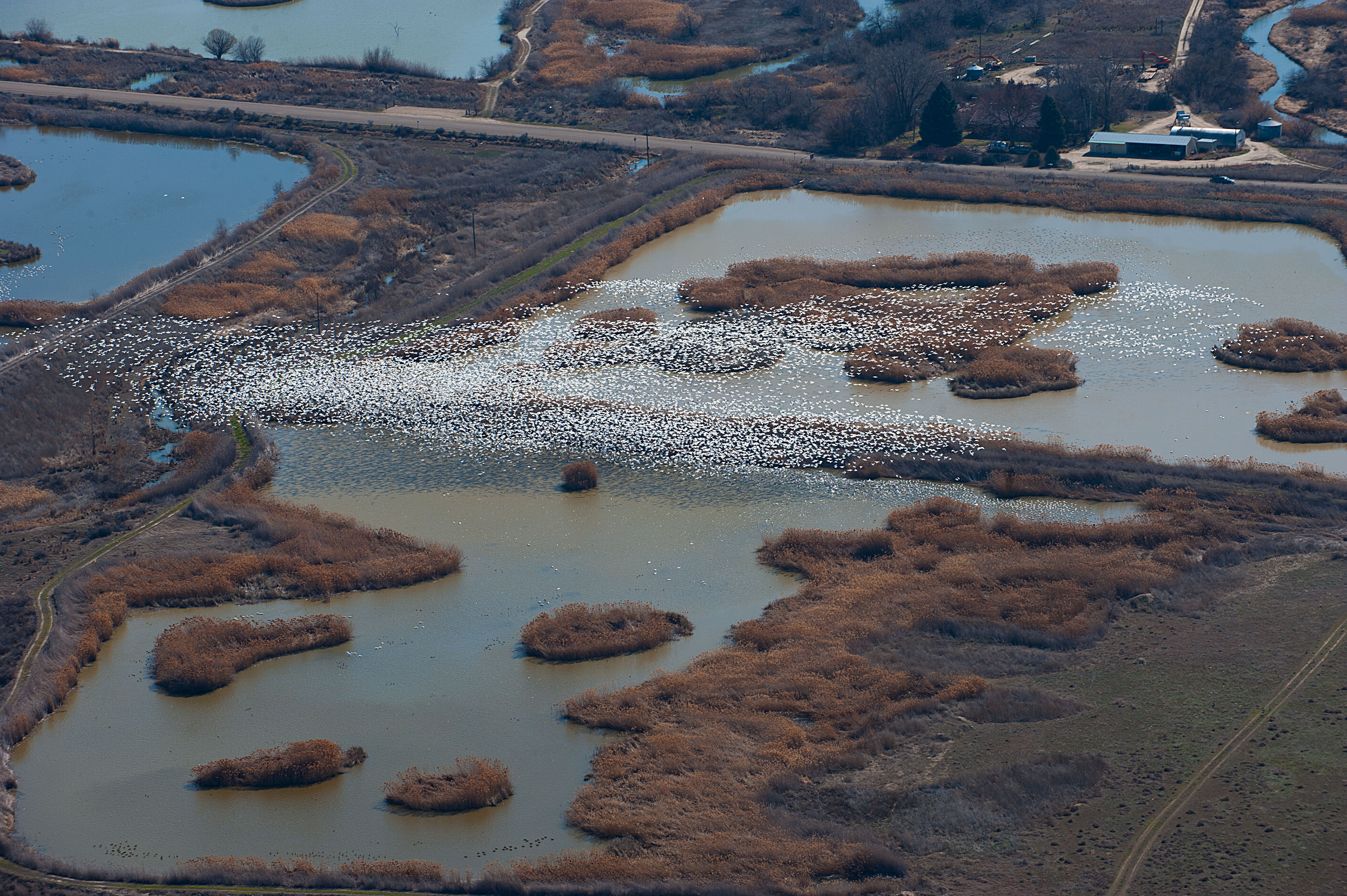
Market Lake WMA -- 5,409 acres
The WMA is in Jefferson County and two miles north of Roberts and 17 miles northwest of Idaho Falls and adjacent to the Snake River. Fish and Game has established and managed 1,710 acres of marsh and 28 acres of riparian habitat. The remaining area includes 1,406 acres shrub-steppe habitat, 325 areas of perennial grasslands, and 220 acres of agriculture fields. The WMA is bordered by private farm lands on the west and south.
Market Lake is an important migration and staging area for waterfowl in the Pacific Flyway. The largest concentrations of waterfowl and waterbirds occur in March and April, but fall migration brings large numbers as well. There are 28 species of waterfowl that use Market Lake, with the most common being Canada goose, mallard, gadwall, American widgeon, northern pintail, green-winged teal, cinnamon teal, redhead, lesser scaup.
There are a number of different marsh areas that draw ducks and waterfowl hunters. In the main marsh, hunters will need a boat and a dog to navigate the cattails, but some other marsh areas provide walk-in access and (provided you have waders) can be hunted without a dog – although it would still be helpful. Most of the opportunity on Market Lake comes early in the season. Freeze-up of the marsh is typically the middle of November.
The agricultural fields in the WMA are rotated between barley, millet, alfalfa, and cover crop mixes, and provide food for waterfowl and additional opportunity for hunters. Fish and Game floods some of the agricultural fields early in the season, and there is dry land hunting opportunity to be had later in the season.
Mud Lake WMA
This WMA in Jefferson County is three miles north of Terreton and 35 miles nort hwest of Idaho Falls. The WMA is adjacent to the 4,500-plus acre Mud Lake and the 10,500 acre Camas National Wildlife Refuge. Mud Lake WMA is bordered by private farm lands on the east and south, and partially on the west.
Two deep marsh units and numerous shallow flooded wetlands contain vital stopover habitat and nesting habitat for waterfowl. Between 950 and 1,150 acres of the WMA are managed as agricultural land.
As with nearby Market Lake, there are 28 species of waterfowl use the WMA, with the most common being Canada geese, mallard, gadwall, widgeon, northern pintail, green-winged teal, cinnamon teal, readhead and lesser scaup. Duck hunting opens near the first weekend of October most years and continues until Mud Lake freezes over, which is typically the third week of November.
Mud Lake is about five feet deep on average, so hunters in the deep marsh areas will need a boat. Retrieving birds there, or finding birds in the cattails in shallower areas, is also made a lot easier with a dog.
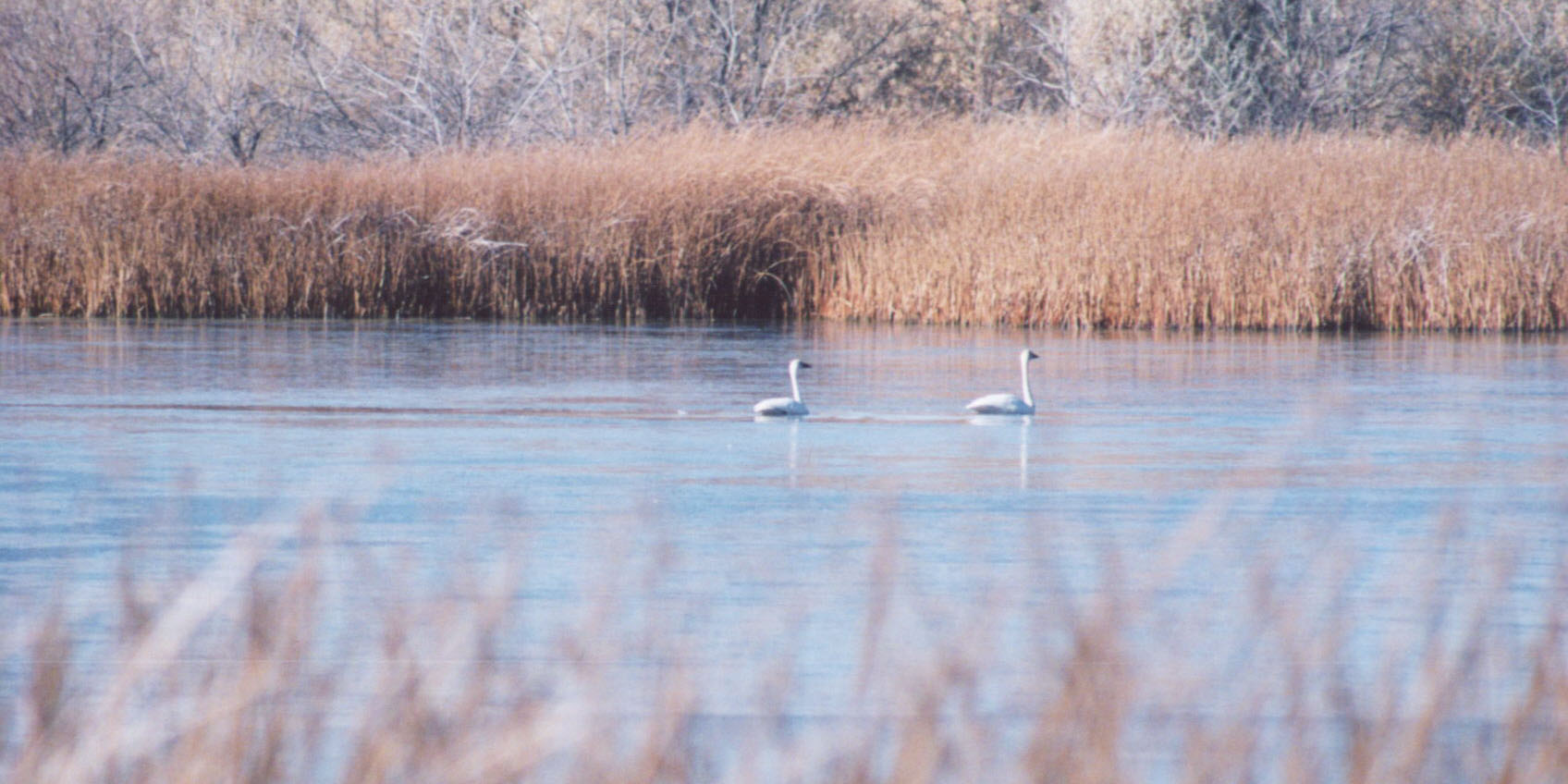
Cartier Slough WMA -- 1,028 acres
This WMA is located along the west side of the Henrys Fork of the Snake River west of Rexburg and south of Highway 33. A variety of habitats are present, including riverbanks, slough channels, wet meadows, shallow ponds, scrub-shrub wetlands, and riparian grasslands. The area is basically a wetland with very little water control. Water levels are dependent on the level of the Henrys Fork of the Snake River.
Canada geese and a diversity of ducks use the area for nesting, brood rearing, and staging during migration. Trumpeter swans are common here, so hunters should be certain to identify their target, especially if they're hunting snow geese. Early season tends to provide the best waterfowl hunting, and most opportunity is found along the river. Freeze-up normally occurs in mid-November with river open until mid-December.
Deer Parks WMU -- 3,101 acres
This WMU is three separate parcels of land located along and near the South Fork, Henrys Fork and mainstem Snake rivers, about 20 miles north of Idaho Falls. Each of the three segments -- Boyle, Menan and Beaver Dick -- can provide good waterfowl hunting.
Sloughs along the river can be productive early on, and the river itself provides opportunities later into the fall and winter. Agricultural crops are grown on portions of Deer Parks, many of which are planted specifically with waterfowl in mind. These areas provide an opportunity for dry land hunting, which is productive later in the season and doesn't require a dog.
Trumpeter swans are common here, particularly later in the season, so hunters should be certain to identify their target, especially if they're hunting snow geese.
Sand Creek WMA -- 32,489 acres
This WMA is a collection of several parcels located in Fremont County. It's strictly an early season option for waterfowl hunters that can be hunted prior to freeze up, which usually happens in mid-November, but can happen earlier in some years. The WMA has two sections that are of interest to waterfowl hunters: the Chapman segment and the Chester Wetland segment.
The Chester segment is located along the Henry's Fork of the Snake River and includes of 762 acres of wetlands, with a handful of ponds: Singleton Pond, Mallard Pond, Backward Pond, and the West ponds. While hunters could pack in a kayak or a canoe on foot, it's a long walk from the parking areas. The ponds offer some opportunity to hunt over decoys, as does the 1.7 miles of river access along the Henry's Fork, which can be hunted after the ponds freeze. There are islands and braids that are great spots to set up decoys. While most of the water in that stretch of river is between knee and hip deep, the current is relatively swift and a dog is recommended for retrieving birds. In addition to the Chester Wetlands Segment itself, there is private property enrolled in Fish and Game's Access Yes! program on three of four sides, offering additional hunting options.
The Chapman segment is used less by waterfowl hunters and doesn't hold quite the same numbers of waterfowl, but does provide some waterfowl hunting opportunity. There are four ponds in the Chapman segment, known collectively as the Sand Creek Ponds. There are also jump shooting opportunities available in the canals in this segment. The Sand Creek Ponds are often deep, so a dog, boat, float tube, or kayak is highly recommended.