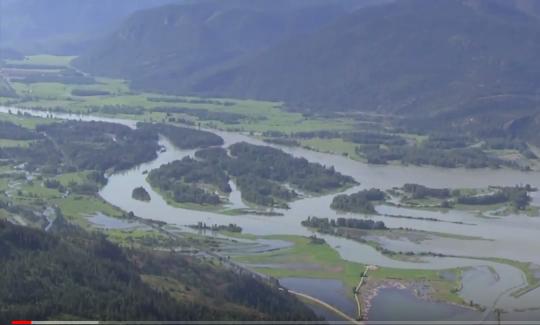
The Clark Fork River is the principal tributary to Lake Pend Oreille and the Clark Fork River delta is the largest area of contiguous wetland complex in the Pend Oreille system.
The delta forms where the Clark Fork River enters Lake Pend Oreille, about three miles west of Clark Fork, Idaho. The delta extends roughly four miles downriver from the town of Clark Fork and is roughly three miles wide where the delta meets Lake Pend Oreille.
About 80 percent of all water entering Lake Pend Oreille is from the Clark Fork River.
The Clark Fork River delta was formed by mixed alluvium and deltaic deposits of the Clark Fork River. These materials consist primarily of soft clayey silt that are underlain at depth by late glacial outwash, till, or Missoula Flood deposits. The fine-grained deltaic sediments were deposited in slack water by a low-gradient river. Numerous shifting channels, meanders, and oxbows formed during delta construction. On the lake side of the delta, wave action and changing lake levels formed barrier beaches.