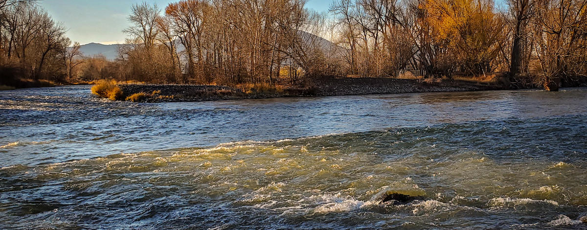
The upper Salmon River in the fall is known for having good river conditions - especially those weeks where the river is "steelhead green", but so far this fall the river hasn't had its usual appearance. We've received many questions about the cloudiness of the upper Salmon River, and hope that this article will help explain why the river has been off-color since September.
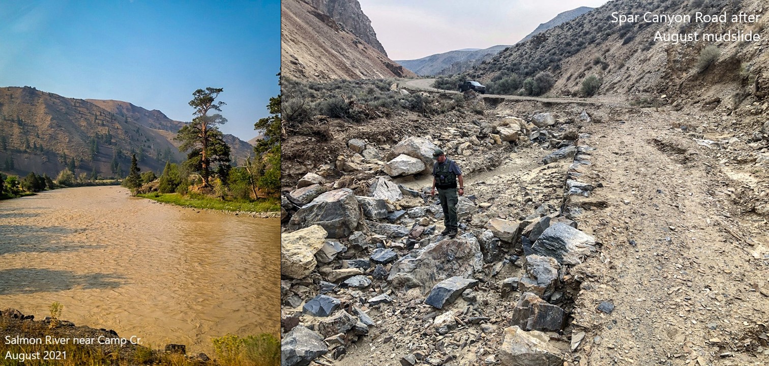
The cloudiness that anglers are seeing in the Salmon River this fall stems from mudslides that took place on August 1, 2021. Numerous drainages and gulches upstream of Challis (Malm Gulch, East Fork Salmon River) received multiple inches of rain over a short period of time, which caused several mudslides. Those mudslides caused the Salmon River to run muddy for approximately two weeks in early August (shown in the picture below).
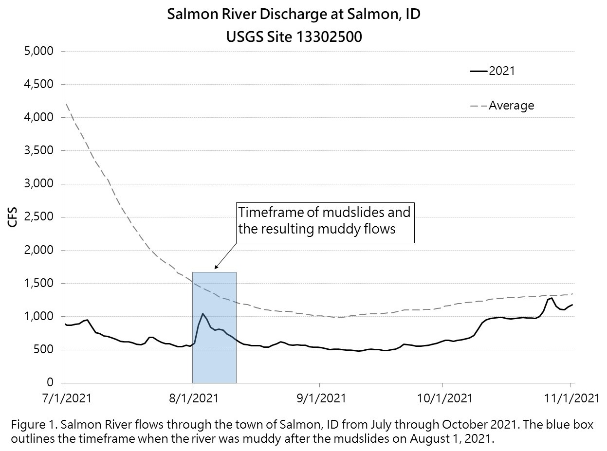
While mudslides along the Salmon River are not particularly unusual, what was unusual was how many there were and how low the Salmon River was when they occurred. As the figure below shows, the flows in the Salmon River were well under 50% of average prior to August 1st and even with multiple inches of rain falling over such a short period of time, river levels only rose to 75% of average. A river's ability to transport sediment is directly related to its flow, and with such low flows in August 2021, much of the sediment suspended in the water settled along the banks and riverbed instead of being carried downstream.
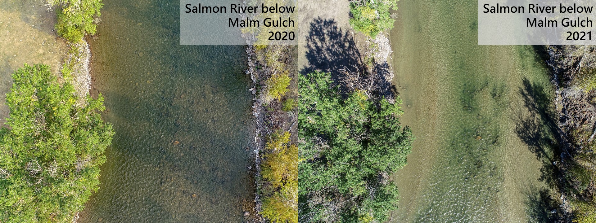
To see how much sediment was introduced to and settled into the river from these mudslides, below are two pictures of the East Fork Salmon and Salmon rivers that show how the same locations looked before and after the mudslides of 2021. The pictures on the left are from September 2020, compared to September 2021 shown on the right. Each picture shows where sediment has settled along the banks and throughout the riverbed, with large amounts settling in areas with slow moving current.
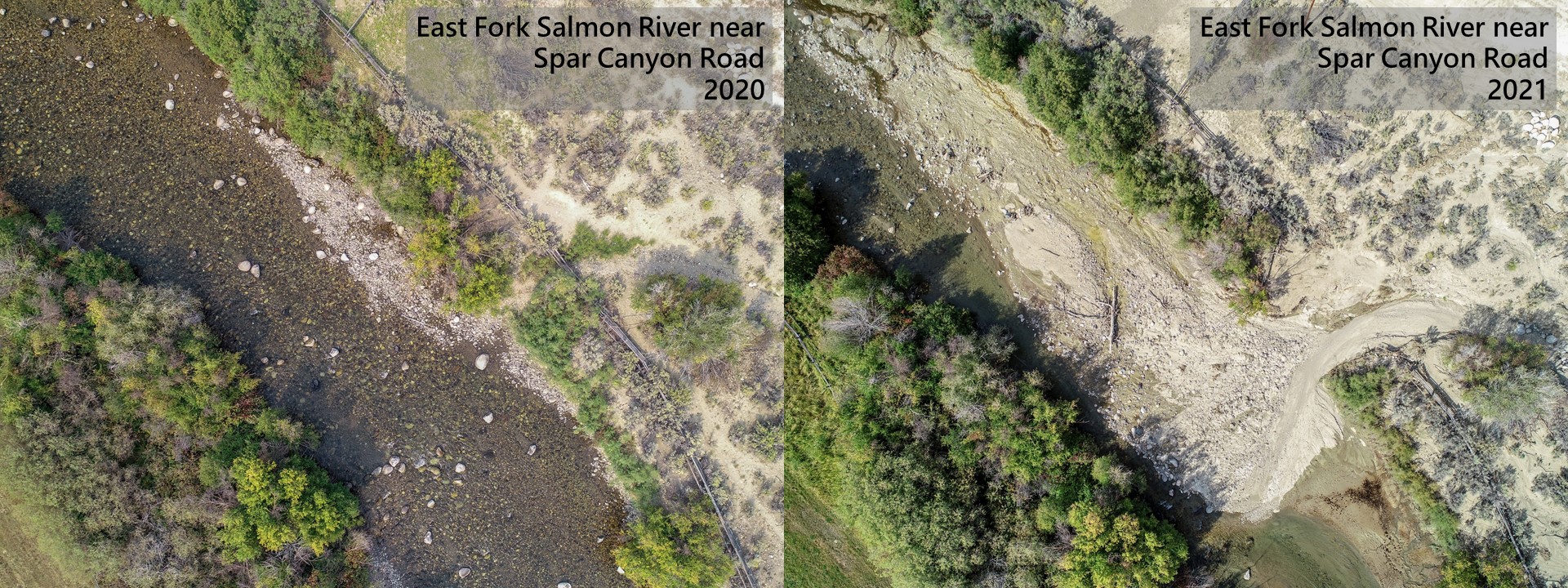
It is the movement of the sediment shown in the photos above that is causing the cloudiness that anglers are seeing this fall. We've seen the Salmon River turn off-color with small increases in stream flow since the mudslides occurred in August. As mentioned earlier, it took nearly two weeks after the mudslides for the river to clear, and when it finally did the flows had dropped back down under 600 cfs through the town of Salmon, ID. Flows stayed low and steady until mid-September, but with rain throughout the fall, we've seen river levels increase. That increase in stream flow has been moving the fine sediment that had settled throughout the river and causing the off-color conditions anglers have been dealing with.
So how long will the Salmon River stay cloudy? This is the question we have heard the most, and unfortunately there is no easy answer. What we do know is that any extended period of stable flows will allow visibility to improve, but any large increases in flow before next year's high water will likely result in the river turning off-color. Flows on the upper Salmon River tend to be stable in late fall and winter so we expect the river to gradually clear up but are unable to predict how quickly this will happen. Ultimately, the majority of this sediment will likely be flushed out next year when snow melt and rain cause river flows to peak, but how much remains will depend on how high the flows get during runoff.
River conditions can change quickly, and it can be difficult to locate timely information. Luckily, multiple resources exist for anglers to gather up-to-date information about conditions on the upper Salmon River. One resource is the Upper Salmon River Weekly Steelhead Reports on the IDFG website. These reports are posted each week in the fall from early October through November and each week in the spring from mid-February through April. The most recent weekly report can be viewed here. Another resource is a newly installed webcam in Salmon, ID that allows anglers to view the upper Salmon River in real time. To view the webcam, anglers can follow this link. Additionally, anglers can check river flows by visiting the USGS WaterWatch website and selecting one of the three gauging sites on the upper Salmon River: Salmon River below Yankee Fork, Salmon River at Salmon ID, and Salmon River near Shoup ID.