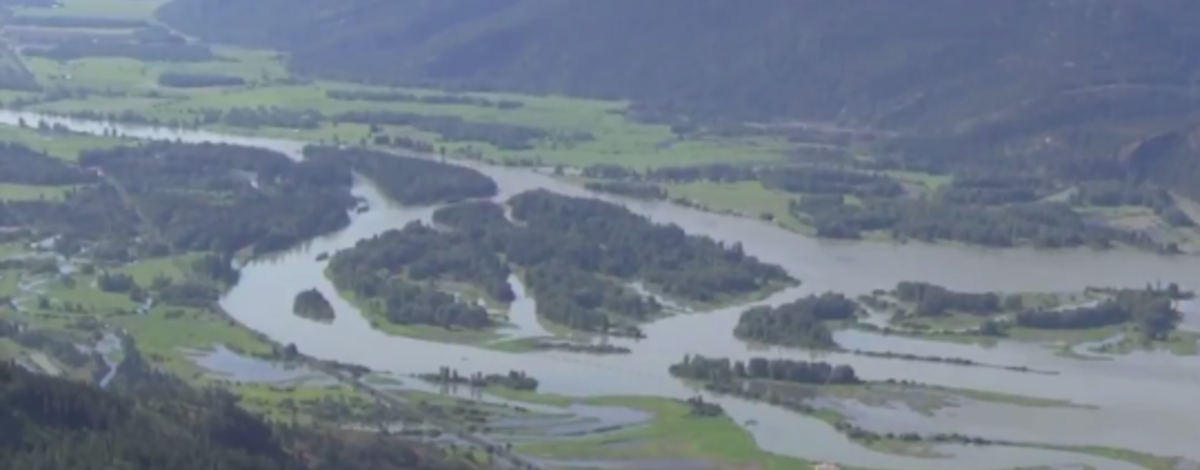
Extensive bank erosion has occurred to islands and shorelines in the Clark Fork River, located at the confluence of the Clark Fork River and Lake Pend Oreille in North Idaho, resulting in losses of soil, native riparian and wetland vegetation, as well as the quantity and quality of fish and wildlife habitat. It is estimated that between 12-15 acres are lost annually to the operation of several dams on the watershed.
The majority of the erosion of the delta soils is the result of wave action and water level fluctuations of Lake Pend Oreille due to the operation of the Albeni Falls dam, located on the Pend Oreille River near the Washington/Idaho border. In addition, about 15–25 percent of all habitat loss in the delta is attributed to the operation of the Cabinet Gorge/Noxon Rapid hydroelectric projects located upstream on the Clark Fork River.
The altered hydrology in the Clark Fork River and delta has also resulted in changes in the wetland and aquatic vegetation cover. Reed canarygrass (Phalaris arundinacea), an invasive non-native now dominates in all delta habitat areas, such that many of the delta’s wetland functions are severely impaired.
A restoration project was proposed by the Idaho Department of Fish and Game and their partners to protect areas vulnerable to erosion while improving and diversifying key riparian and wetland habitats behind the protection to restore ecological function in the delta.
A short documentary film was produced by Scott Rulander and submitted to the University of Idaho Film Festival commencing in October 2017. The film entitled, “Clark Fork River Delta; Restoring Wildlife Habitat For Future Generations” speaks to some of the work completed and the importance of the delta to the fish and wildlife resources.
The film shows some of the construction efforts completed for a portion of Phase I of the restoration project. The construction began in November 2014, and was completed by March 2015.
Construction efforts included:
- Island shoreline rock protection completed: Area 3 = 17,600 linear feet and Area 7 = 2,890 linear feet
- Over 50,000 tons riprap rock placed in Area 3 and Area 7
- 51,000 willows embedded in rock
- 330 trees with root-wads embedded into fill/rock
- 13 Bendway weirs constructed on Area 3
- 40 acres raised on Area 3
- A total of 100,549 plants were planted between April and June of 2015.
- Approximately 20,813 shrubs and trees were planted by volunteers, school groups and IDFG staff.
- A total of 79,736 emergent plugs were planted by volunteers and two crews from the Northwest Youth Corp.
- The invasive reed canarygrass was treated with prescribed burn; the grass clumps were also sprayed with systemic herbicides.
Future generations will continue to enjoy the wetland habitats of the Clark Fork River delta now that some of the shorelines and low-lying areas are protected from eroding wave action; still, there is much more work to do and the battle to reduce the presence of reed canarygrass is just starting.