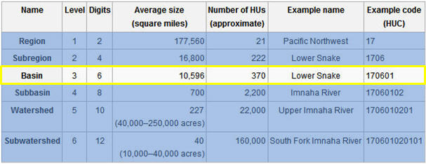
Mystified by the often-confusing terminology associated with water drainage naming and numbering?
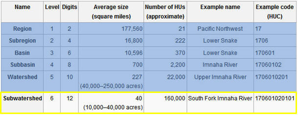
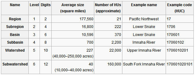
This table relates well to the official NHD/USGS system (source: Wikipedia 2015Feb05).
The GIS layer Hydrologic Units includes Level 3 (3rd-code/6-digit) through Level 6 (6th-code/12-digit) polygons.
These images should help clarify, beginning at the HUC3 level,
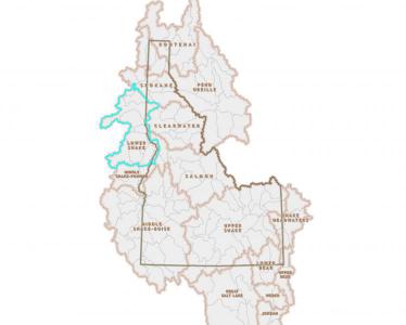
Lower Snake River Basin selected:
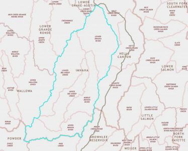
Zoom in to HUC4 with Imnaha River (Oregon) Subbasin selected:

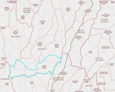
Zoom in to HUC5 with Upper Imnaha River Watershed selected:
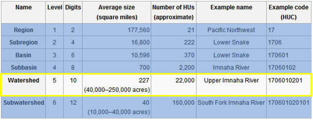
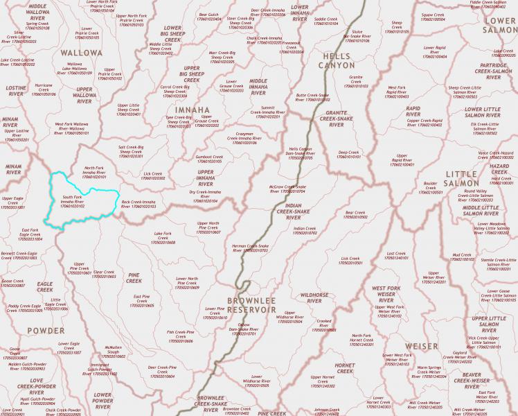
Zoom to HUC6, South Fork Imnaha River Subwatershed selected: