Although there is a tool in ArcToolbox (Layer to KML) that allows you to convert your ArcGIS file to a Google Earth KML file, this tool gives you no options for customizing how the information is displayed.
Let me present to you the opensource (aka FREE) Shp2kml tool:
http://www.zonums.com/shp2kml.html
Note: The Download link is actually half way down the webpage, the large Start Download button at the top of the page is part of an ad for a different product.
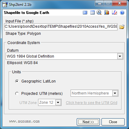
Step 1: Choose your input file and coordinate system.
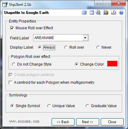
Step 2: Decide which attribute you want to use as the label and check 'Mouse Roll over Effect' if you want to highlight a feature when the mouse is moved over it.
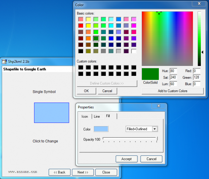
Step 3: Decide what color and transparency (opacity) you features will be.
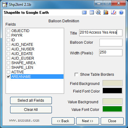
Step 4: Decide what attribute information you would like in the pop-up balloon when a feature is clicked or selected and customize the balloons symbology.
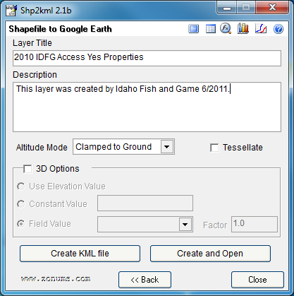
Step 5: Give the kml layer a name and any descriptive information you would like and your done!
BRILLIANT!