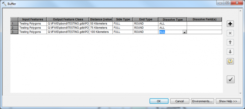
Let’s say you have a polygon shapefile that you want to buffer using 3 different buffer distances. You can use the Batch command to do this automatically; you just have to fill in the necessary information. (Note: Batch can be performed for any tool in ArcToolbox).
o Find the Buffer tool in ArcToolbox, right click it and choose Batch… The dialog box will ask you for all of the same information that the regular Buffer tool dialog box asks for, the only differences is you can make multiple entries by clicking the  button.