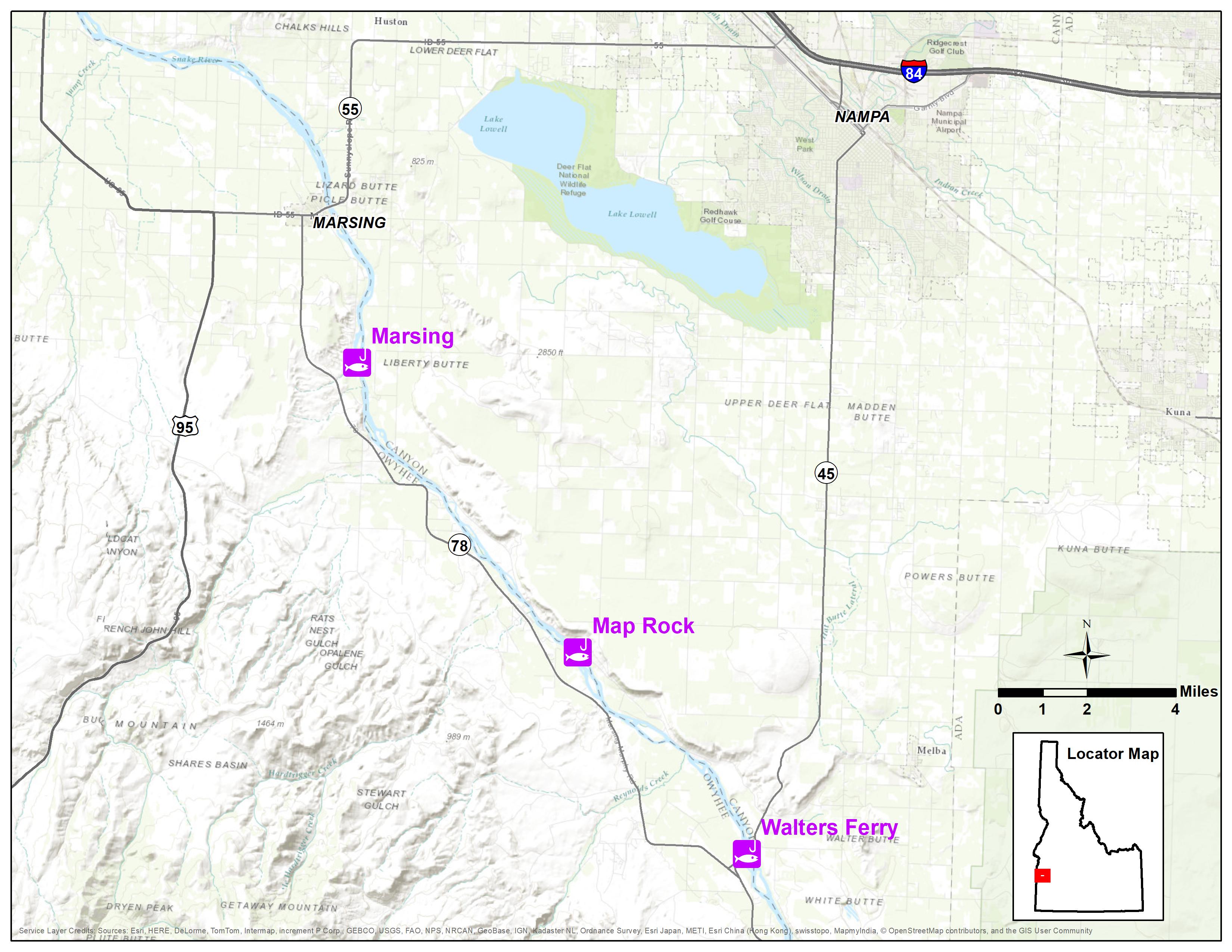
Work begins Feb. 26 on a fishing access improvement project at the Map Rock boat ramp along the Snake River south of Nampa, which will require public closure to the work site. The site is about 6 miles downstream from Walters Ferry on Map Rock Road on the north side of the river. It is one of five Fish and Game boat ramps that access 18 miles of popular fishing waters between Walters Ferry and Marsing.
The project includes replacing a decaying boat ramp, which means the existing Map Rock boat ramp will be closed from Feb. 26 into spring. Exact date of reopening will be weather dependent.
The renovation project also includes a new outhouse and parking area. When completed, vehicles will be limited to developed roads and parking areas, and there will be walk-in access from the newly expanded parking area near the boat ramp and at the west end of the property. A new outhouse at the boat ramp will have solar lighting to improve security and make the area more friendly to night anglers.
“Our hope is after completion, this project will make Map Rock a clean and safe place to take the family and enjoy fishing,” said Dennis Hardy, F&G’s boating and fishing access coordinator.
Camping will no longer be allowed at the site, but night angling is allowed as long as anglers do not establish a camp, such as set up a tent, use an RV or set up a shelter for an extended stay.
The traditional busy season for the Map Rock ramp is during fall and winter waterfowl season, but it’s also popular for bass and catfish anglers during warmer months. Anglers and boaters will have other ramps available between Walters Ferry and Marsing during renovation of the Map Rock site, including:
Walters Ferry: South side of the river off Idaho 45 about 19 miles south of Nampa.
Bernard Landing: 5 miles downstream of Walters Ferry off Idaho 78 on the south side of the river.
Marsing Access: 4.5 miles downstream of Walter Ferry on the south side of the river off of South Bruneau Highway.
Trapper Flat: 10.7 miles downstream of Walters Ferry, north side of the river off Map Rock Road. Note: This ramp is suitable for small boats, but tough to launch larger boats and also has problems with aquatic weeds during warmer months.