Let’s say you would like to upload Game Management Unit 1 to your GPS.
1) Download the Game Management Units KML from the IFWIS Open Data, data-idfggis.opendata.arcgis.com. (HINT: Click the 'Download Dataset' button just below the map on the right-hand side and select KML.)
2) Open the KML in Google Earth. Right-click “1” in the gmu features list. Select “Save Place As…”
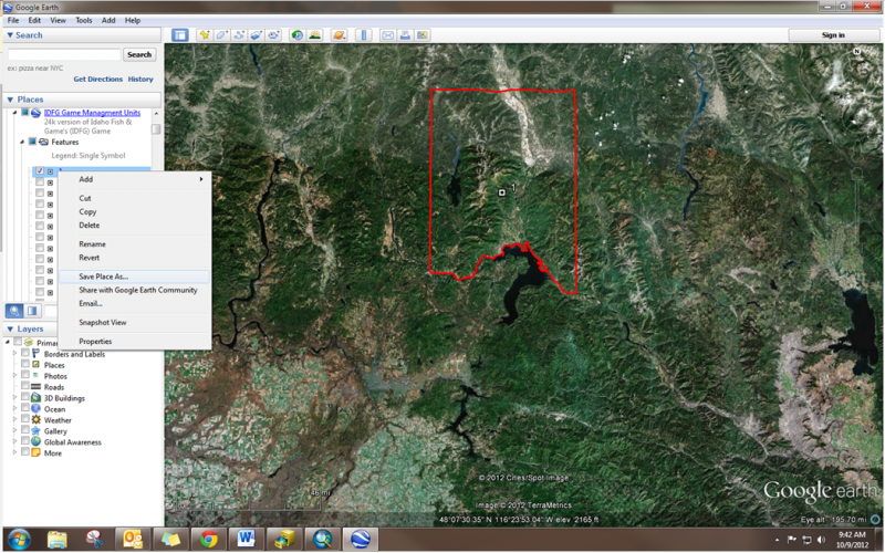
3) Save the feature as a KML (not a KMZ).
4) Convert the KML to a GPX file. There are many open-source software options. I like KML2GPX.exe (download from https://groups.google.com/forum/?fromgroups=#!msg/kml-support-getting-started/5K7vcIGUz6s/_EvtN-YqXuwJ) and GPSBabel (download from http://www.gpsbabel.org/).
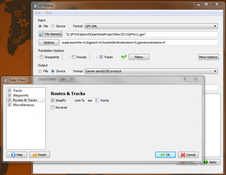
5) Upload the GPX file as a track to your GPS. NOTE: for those GPS units with smaller data storage space or without a data storage card the track may be too large to upload without simplifying. Using GPSBabel, you can apply a “Filter” to the Routes & Tracks to simplify the boundary. For units such as the etrex Vista Cx, I know that the track point upload limit is 500 (otherwise it will give you a message that says “track truncated”. The Minnesota DNRGPS Application also works well for uploading data but I have not found a way to simplify the track using this software (http://www.dnr.state.mn.us/mis/gis/DNRGPS/DNRGPS.html).
There are many different tactics for completing this process but these are the steps that have given me the least amounts of difficulties for a number of different Garmin GPS units. These steps have not been tested on Magellan, Lowrance, TomTom, etc.
Do you have another method that works better for you? Please share in the comment below!