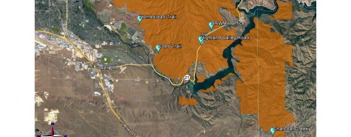
The Charcoal Creek segment of the Boise River Wildlife Management Area is now closed to all public entry. This portion of land is located south and east of Lucky Peak Reservoir and north of the Blacks Creek Road.
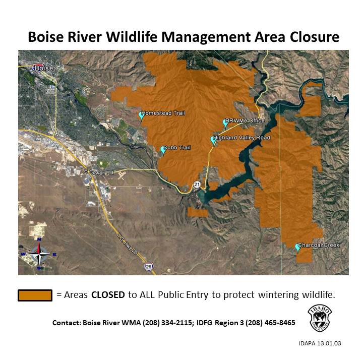
This closure is in addition to the one that occurred in late January for the Boise Front Segment. Both closures have been instituted to help protect wintering big game animals and will remain in effect until further notice.
The closures eliminate a source of stress for big game animals already dealing with abundant snow and low temperatures in the area.
“Providing secure areas for these animals to weather the storms, without additional stress from human disturbance, can improve their chances to survive the winter,” said Zach Swearingen, Fish and Game habitat manager.
The area was established to permanently protect portions of big game critical winter range in the Boise Foothills. Large numbers of mule deer and elk migrate from the Sawtooth Mountains to winter there. During severe winters, approximately 7,000 mule deer can utilize the area. Minimizing disturbance to wintering animals can have large impacts in helping them conserve energy and survive until spring arrives.
For more information and a map of the property please go to: https://idfg.idaho.gov/visit/wildlife-management-areas. Under the Wildlife Management Areas by Region box, click on “Southwest” and scroll down to the Boise River WMA page.