Idaho Hunt Planner We got game.
Hunt Area
Entire State Open.
More information about the Game Management Unit(s) in this area: UNK 1 2 3 4 4A 5 6 7 8 8A 9 10 10A 11 11A 12 13 14 15 16 16A 17 18 19 19A 20 20A 21 21A 22 23 24 25 26 27 28 29 30 30A 31 32 32A 33 33 34 35 36 36A 36B 37 37A 38 39 39 40 41 42 43 44 45 46 47 48 49 50 51 52 52A 53 54 55 56 57 58 59 59A 60 60A 61 62 62A 63 63A 64 65 66 66A 67 68 68A 69 70 71 72 73 73A 74 75 76 77 78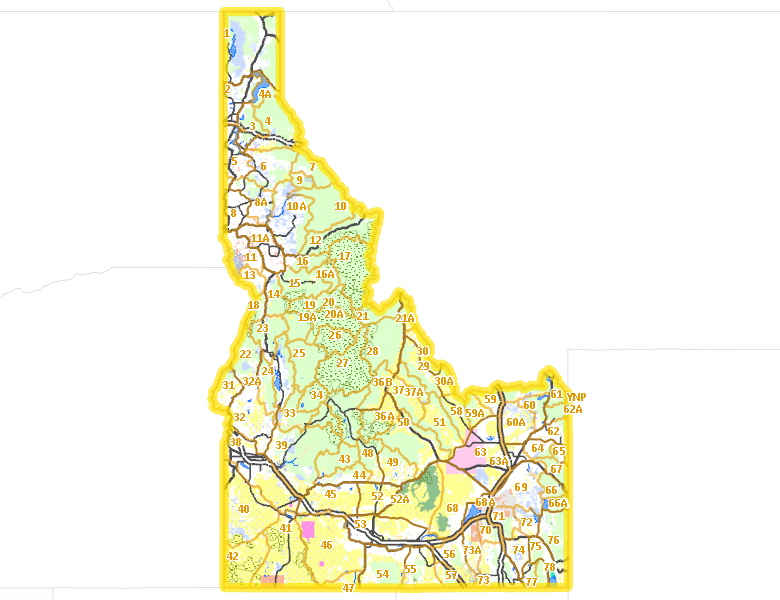
Surface Management
For government land, these data show the managing agency of the land, which may or not be the same as the owning agency.
 U.S. Forest Service (USFS) 37.94%
|
|
Private 29.7%
|
|
U.S. Bureau of Land Management (BLM) 21.88%
|
|
State of Idaho 5.07%
|
|
Indian Reservation / Bureau of Indian Affairs 1.75%
|
|
U.S. Department of Energy (DOE) 1.05%
|
|
U.S. National Park Service (NPS) 0.96%
|
|
Other 0.63%
|
|
U.S. Bureau of Reclamation (BOR) 0.37%
|
|
U.S. Military 0.24%
|
|
U.S. Department of Interior (DOI) 0.13%
|
|
U.S. Department of Agriculture (USDA) 0.09%
|
|
U.S. Corps of Engineers (COE) 0.05%
|
|
U.S. National Wildlife Refuge (NWR) 0.04%
|
Make your own map of Hunt Area
Ownership data source: Inside Idaho
Access Yes! Properties
Access Yes! is Fish and Game program designed to improve hunting and fishing access to private land or through private land to public land by compensating willing landowners who provide access.
- Mica Creek Drainage on St. Joe River
- Hugas Creek & St. Joe River Basin
- Paddock Valley Reservoir
- Sturgill Creek
- Letha - Payette River Access
- Rinker Rock Creek Ranch
- Fox Hills Ranch
- Diamond A Livestock - Little Pilgrim Gulch
- Wood River Land Trust - Draper Wood River Preserve
- Colorado Gulch Preserve
- East of Ririe Reservoir/Meadow Creek Junction
Forest Service Land
Check for road and area closures on National Forest websites
- Bitterroot National Forest
- Boise National Forest
- Caribou National Forest
- Clearwater National Forest
- Coeur d'Alene National Forest
- Kaniksu National Forest
- Kootenai National Forest
- Nezperce National Forest
- Payette National Forest
- Sawtooth National Forest
- St. Joe National Forest
- Targhee National Forest
- Salmon-Challis National Forest
Federally-designated Wilderness Areas
No motorized vehicles are allowed in these areas.
- Frank Church - River of No Return Wilderness 2,357,999 acres (4.41% of hunt area)
- Selway Bitterroot Wilderness 1,092,240 acres (2.04% of hunt area)
- Owyhee River Wilderness 272,397 acres (0.51% of hunt area)
- Sawtooth Wilderness 217,590 acres (0.41% of hunt area)
- Gospel Hump Wilderness 205,589 acres (0.38% of hunt area)
- Bruneau-Jarbridge Rivers Wilderness 94,853 acres (0.18% of hunt area)
- Hells Canyon Wilderness 86,379 acres (0.16% of hunt area)
- Big Jacks Creek Wilderness 56,546 acres (0.11% of hunt area)
- Little Jacks Creek Wilderness 54,935 acres (0.1% of hunt area)
- North Fork Owyhee Wilderness 44,684 acres (0.08% of hunt area)
- Pole Creek Wilderness 13,405 acres (0.03% of hunt area)
Land Use/Land Cover
|
Forest
40.39
%
|
|
Rangeland
38.06
%
|
|
Dryland Agriculture
8.17
%
|
|
Irrigated-Gravity Flow
5.29
%
|
|
Irrigated-Sprinkler
4.61
%
|
|
Riparian
1.12
%
|
|
Rock
1.05
%
|
|
Water
0.71
%
|
|
Urban
0.58
%
|
Make your own map of Hunt Area
Land Use data source: IDWR
Towns in this Hunt Area
- Boise, Interstate 84 Idaho 55 Idaho 21
- Nampa, Interstate 84 Idaho 55
- Pocatello, Interstate 86 Interstate 15 US 91
- Idaho Falls, Interstate 15 US 20 US 26
- Meridian, Interstate 84 US 20-26
- Coeur d'Alene, US 95 Interstate 90
- Twin Falls, Interstate 84 US 93 US 30
- Lewiston, US 95 US 12
- Caldwell, Interstate 84 US 20-26 Idaho 55
- Moscow, US 95
- Post Falls, Interstate 90
- Rexburg, US 20 Idaho 33
- Eagle, Idaho 55 Idaho 44
- Mountain Home, Interstate 84 US 20 Idaho 51
- Garden City, Idaho 55 Interstate 84
- Blackfoot, Interstate 15 US 26 US 91
- Chubbuck, Interstate 86
- Burley, Interstate 84 Idaho 27 US 30
- Jerome, Idaho 79 Interstate 84
- Kuna, Idaho 69
- Sandpoint, US 95 US 2 Idaho 200
- Payette, US 95 Idaho 52
- Hailey, Idaho 75
- Emmett, Idaho 52
- Rupert, Interstate 84 Idaho 24
- Weiser, US 95
- Rathdrum, Idaho 53
- Preston, US 91 Idaho 36
- Sun Valley / Ketchum, Idaho 75
- American Falls, Interstate 86 Idaho 39
- Fruitland, US 30 US 95
- Buhl, US 30
- Shelley, US 91
- Soda Springs, US 30
- Gooding, US 26 Idaho 46
- St. Anthony, US 20
- Grangeville, US 95
- Orofino, US 12
- North Fork, US 93
- Salmon, US 93
- Rigby, US 20 Idaho 48
- Heyburn, Interstate 84 US 30
- Montpelier, US 89 US 30
- Bonners Ferry, US 95
- St. Maries, Idaho 3
- Homedale, US 95
- Driggs / Tetonia / Victor, Idaho 33
- Cataldo, Interstate 90
- Wendell, Interstate 84
- Kellogg, Interstate 90
- Malad City, Interstate 15
- McCall, Idaho 55
- Bellevue, Idaho 75
- Garden Valley, Garden Valley Rd.
- Murray / Prichard, Interstate 90
- Aberdeen, Idaho 39
- Priest River, Idaho 57 US 2
- Parma, US 95
- Filer, US 30
- Glenns Ferry, Interstate 84
- Wilder, US 95
- Shoshone, US 26 US 93 Idaho 24
- Spirit Lake, Idaho 41
- New Plymouth, Idaho 52 US 30
- Kamiah, US 12
- Ashton, US 20 Idaho 32 Idaho 47
- Arco, US 20-26 US 93
- Grace, Idaho 34
- Plummer, US 95
- Cascade, Idaho 55
- Marsing, Idaho 55
- Cottonwood, US 95
- Wallace, Interstate 90
- Challis, US 93
- Craigmont / Winchester, US 95
- Horseshoe Bend, Idaho 55 Idaho 52
- Troy, Idaho 8
- Potlatch, Idaho 6 US 95
- Council, US 95
- Elk City, Idaho 14
- Dubois, Interstate 15 Idaho 22
- Hagerman, US 30
- Athol, US 95 Interstate 90
- Kooskia, US 12 Idaho 13
- Oakley, Idaho 27
- Franklin, US 91
- Hope / Clark Fork, Idaho 200
- Downey, US 91
- Priest Lake, Idaho 57
- Pierce, Idaho 11
- Paris, US 89
- Mackay, US 93
- Deary, Idaho 8
- Ririe, US 26
- Lava Hot Springs, US 30
- New Meadows, US 95 Idaho 55
- Idaho City, Idaho 21
- Grand View, Idaho 78
- Riggins, US 95
- Fairfield, US 20
- Weippe, Idaho 11
- Cambridge, US 95
- Bliss, Interstate 84
- Mud Lake, Idaho 33
- Harrison, Idaho 97
- Albion, Idaho 77
- Hollister, US 93
- Worley, US 95
- Swan Valley, US 26 Idaho 31
- Island Park, US 20
- Lowman, Idaho 21
- Bayview, US 95
- Elk River, Idaho 8
- Minidoka, Idaho 24
- White Bird, US 95
- Bruneau, Idaho 51
- Stanley, Idaho 75 Idaho 21
- Leadore, Idaho 28 Idaho 29
- Murphy, Idaho 78
- Rogerson, US 93
- Yellow Pine, East Fork Rd.
- Spencer, Interstate 15
- Lowell, US 12
- Almo, Idaho 77
- Atlanta, Idaho 21
- Blanchard, Idaho 41
- Fort Hall, Interstate 15
- Picabo, US 20
- Silver City, Silver City Rd.
- Tendoy, Idaho 28
- Warm Lake, Warm Lake Rd.
- Wayan, Idaho 34