Idaho Hunt Planner We got game.
Unit 12
- Region 2
- Clearwater Region
- Lolo Elk Zone
- Units 10, 12
Game Management Unit Boundary
Those portions of IDAHO and CLEARWATER COUNTIES within the following boundary: beginning at the junction of the Smith Creek Road (Forest Service Road 101) and the Middle Fork of the Clearwater River, then northeast on the Smith Creek Road to the Lolo Motor Way (Forest Service Road 500), then north along the Lolo Motor Way to the point where it leaves the watershed divide between the North Fork of the Clearwater and Lochsa Rivers at the heads of Papoose Creek and Cayuse Creek, then north along the divide over Williams Peak to the Idaho-Montana State line, then southeast along the state line to the watershed divide between the Lochsa and Selway Rivers, then west along the divide over Diablo Mountain, Elk Summit, McConnell Mountain and Fenn Mountain to the confluence of the Lochsa and Selway Rivers, then down the Middle Fork of the Clearwater River to the Smith Creek Road, the point of beginning.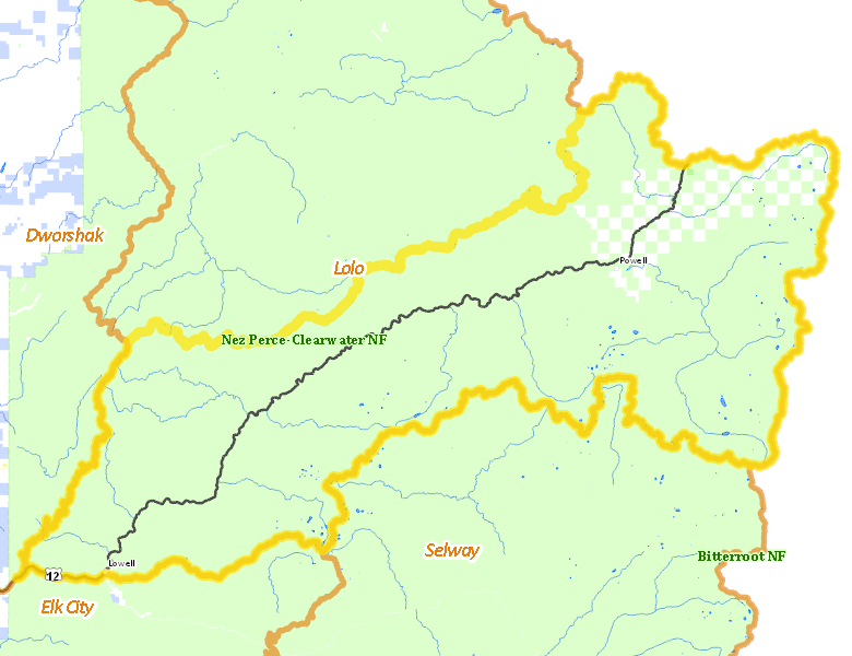
Public Access
Surface Management
For government land, these data show the managing agency of the land, which may or not be the same as the owning agency.
| U.S. Forest Service (USFS) |  94.48
%
94.48
%
|
| Private |
5.25
%
|
| Other |
0.2
%
|
| State of Idaho |
0.02
%
|
Make your own map of Unit 12
Ownership data source: Inside Idaho
Access Yes! Properties
No properties are currently available in Unit 12.
View all Access Yes Participants.
National Forests
Federally-designated Wilderness Areas
No motorized vehicles are allowed in these areas.
-
Selway Bitterroot Wilderness
237,200 acres (31.18% of hunt area)
Land Use/Cover
| Forest |
84.78
%
|
| Rangeland |
15.18
%
|
Make your own map of Unit 12
Land Use data source: IDWR