Idaho Hunt Planner We got game.
Unit 24
- Region 3
- Southwest Region
- McCall Elk Zone
- Units 19A, 23, 24, 25
Game Management Unit Boundary
That portion of VALLEY COUNTY within the drainage of the North Fork of the Payette River, EXCEPT that portion south of the Smiths Ferry Bridge-Packer John Road on the east side of the river and south of the Smith Ferry-High Valley Road on the west side of the river.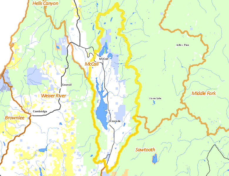
Public Access
Surface Management
For government land, these data show the managing agency of the land, which may or not be the same as the owning agency.
| Private |  42.89
%
42.89
%
|
| U.S. Forest Service (USFS) |
42.78
%
|
| State of Idaho |
10.92
%
|
| Other |
1.62
%
|
| U.S. Bureau of Reclamation (BOR) |
1.41
%
|
| U.S. Bureau of Land Management (BLM) |
0.37
%
|
Make your own map of Unit 24
Ownership data source: Inside Idaho
Access Yes! Properties
No properties are currently available in Unit 24.
View all Access Yes Participants.
National Forests
Federally-designated Wilderness Areas
No motorized vehicles are allowed in these areas.
There are no wilderness areas in Unit 24.
Land Use/Cover
| Forest |
74.64
%
|
| Irrigated-Gravity Flow |
15.09
%
|
| Water |
3.41
%
|
| Rangeland |
3.23
%
|
| Riparian |
2.96
%
|
| Irrigated-Sprinkler |
0.66
%
|
Make your own map of Unit 24
Land Use data source: IDWR