Idaho Hunt Planner We got game.
Unit 19A
- Region 3
- Southwest Region
- McCall Elk Zone
- Units 19A, 23, 24, 25
Game Management Unit Boundary
Those portions of IDAHO and VALLEY COUNTIES within the drainage of the south side of the Salmon River from the French Creek-Burgdorf-Summit Creek Road upstream to the South Fork of the Salmon River, the drainage of the west side of the South Fork of the Salmon River from its mouth upstream to and including the Bear Creek watershed, and the drainage of the Secesh River upstream from the mouth of Paradise Creek (including the Paradise Creek watershed), EXCEPT those portions of the French Creek, Lake Creek and Summit Creek drainages west of the French Creek-Burgdorf-Summit Creek Road.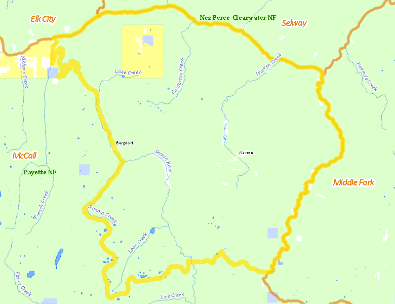
Public Access
Surface Management
For government land, these data show the managing agency of the land, which may or not be the same as the owning agency.
| U.S. Forest Service (USFS) |  94.18
%
94.18
%
|
| U.S. Bureau of Land Management (BLM) |
4.05
%
|
| Private |
1.06
%
|
| State of Idaho |
0.4
%
|
| Other |
0.3
%
|
Make your own map of Unit 19A
Ownership data source: Inside Idaho
Access Yes! Properties
No properties are currently available in Unit 19A.
View all Access Yes Participants.
National Forests
Federally-designated Wilderness Areas
No motorized vehicles are allowed in these areas.
-
Frank Church - River of No Return Wilderness
35,449 acres (12% of hunt area)
Land Use/Cover
| Forest |
100
%
|
| Rangeland |
0
%
|
Make your own map of Unit 19A
Land Use data source: IDWR