Idaho Hunt Planner We got game.
Southwest Region
Region 3
GMU(s) in Southwest Region :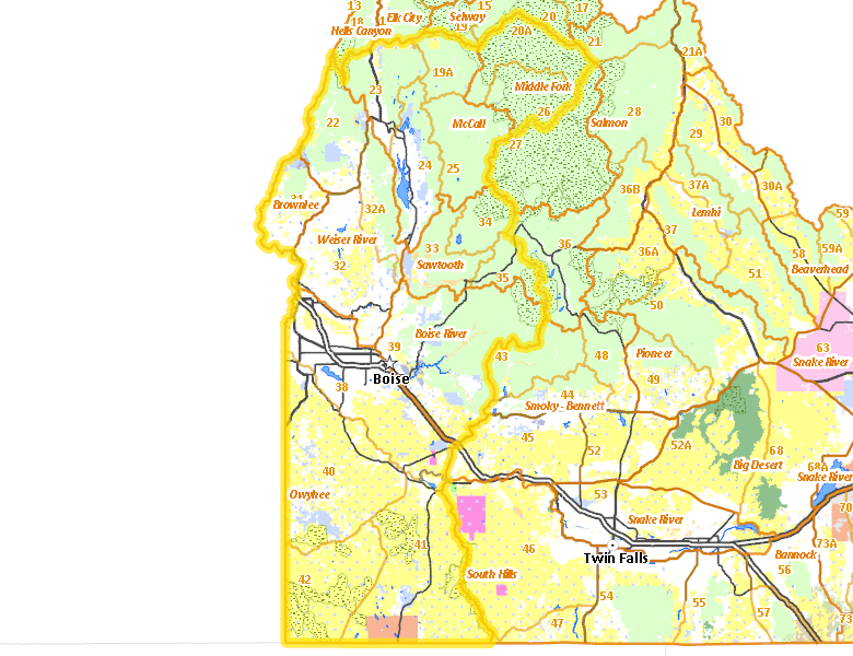
Public Access
Land Ownership
| U.S. Forest Service (USFS) |  36.64
%
36.64
%
|
| U.S. Bureau of Land Management (BLM) |
30.73
%
|
| Private |
24.71
%
|
| State of Idaho |
5.56
%
|
| Indian Reservation / Bureau of Indian Affairs |
1.15
%
|
| U.S. Bureau of Reclamation (BOR) |
0.73
%
|
| Other |
0.31
%
|
| U.S. Military |
0.09
%
|
| U.S. National Wildlife Refuge (NWR) |
0.01
%
|
| U.S. Corps of Engineers (COE) |
0
%
|
Access Yes! Properties
National Forests
- Boise National Forest
- Nezperce National Forest
- Payette National Forest
- Sawtooth National Forest
- Salmon-Challis National Forest
Federally-designated Wilderness Areas
-
Frank Church - River of No Return Wilderness
909,390 acres (7.19% of region) -
Owyhee River Wilderness
272,397 acres (2.15% of region) -
Sawtooth Wilderness
150,110 acres (1.19% of region) -
Bruneau-Jarbridge Rivers Wilderness
64,706 acres (0.51% of region) -
Big Jacks Creek Wilderness
56,546 acres (0.45% of region) -
Little Jacks Creek Wilderness
54,935 acres (0.43% of region) -
North Fork Owyhee Wilderness
44,684 acres (0.35% of region) -
Hells Canyon Wilderness
29,844 acres (0.24% of region) -
Pole Creek Wilderness
13,405 acres (0.11% of region)
Land Use/Cover
| Rangeland |
45.76
%
|
| Forest |
42.92
%
|
| Irrigated-Gravity Flow |
6.5
%
|
| Irrigated-Sprinkler |
1.76
%
|
| Riparian |
1.55
%
|
| Urban |
0.75
%
|
| Water |
0.39
%
|
| Dryland Agriculture |
0.37
%
|
Services
Lodging, Camping & Services in Southwest Region
- Boise - Interstate 84 Idaho 55 Idaho 21
- Nampa - Interstate 84 Idaho 55
- Meridian - Interstate 84 US 20-26
- Caldwell - Interstate 84 US 20-26 Idaho 55
- Eagle - Idaho 55 Idaho 44
- Mountain Home - Interstate 84 US 20 Idaho 51
- Garden City - Idaho 55 Interstate 84
- Kuna - Idaho 69
- Payette - US 95 Idaho 52
- Emmett - Idaho 52
- Weiser - US 95
- Fruitland - US 30 US 95
- Homedale - US 95
- McCall - Idaho 55
- Garden Valley - Garden Valley Rd.
- Parma - US 95
- Wilder - US 95
- New Plymouth - Idaho 52 US 30
- Cascade - Idaho 55
- Marsing - Idaho 55
- Horseshoe Bend - Idaho 55 Idaho 52
- Council - US 95
- New Meadows - US 95 Idaho 55
- Idaho City - Idaho 21
- Grand View - Idaho 78
- Riggins - US 95
- Cambridge - US 95
- Lowman - Idaho 21
- Bruneau - Idaho 51
- Murphy - Idaho 78
- Yellow Pine - East Fork Rd.
- Atlanta - Idaho 21
- Silver City - Silver City Rd.
- Warm Lake - Warm Lake Rd.
* Services pages courtesy of the Official Idaho Travel and Tourism Guide