Idaho Hunt Planner We got game.
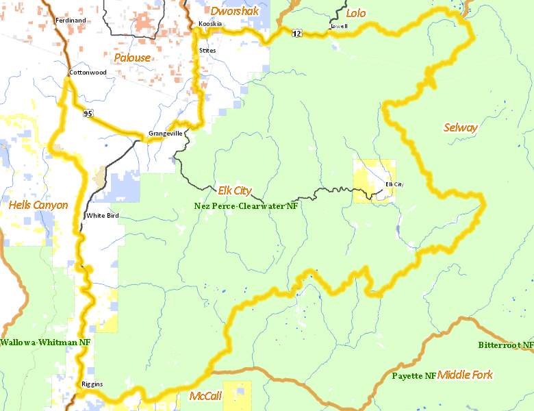
Elk City Zone
Units 14, 15, 16
More information about GMU(s) in Elk City Zone :
Public Access
Land Ownership
| U.S. Forest Service (USFS) |  77.96
%
77.96
%
|
| Private |
17.81
%
|
| U.S. Bureau of Land Management (BLM) |
2.08
%
|
| State of Idaho |
1.66
%
|
| Other |
0.28
%
|
| Indian Reservation / Bureau of Indian Affairs |
0.2
%
|
| U.S. National Wildlife Refuge (NWR) |
0.01
%
|
| U.S. National Park Service (NPS) |
0
%
|
Make your own map of Elk City Zone
Ownership data source: Inside Idaho
Access Yes! Properties
No properties are currently available in Elk City Zone.
View all Access Yes Participants.
National Forests
Federally-designated Wilderness Areas
-
Gospel Hump Wilderness
93,313 acres (7.93% of hunt area) -
Selway Bitterroot Wilderness
12,119 acres (1.03% of hunt area)
Land Use/Cover
| Forest |
82.64
%
|
| Dryland Agriculture |
8.76
%
|
| Rangeland |
8.11
%
|
| Irrigated-Sprinkler |
0.49
%
|
Make your own map of Elk City Zone
Land Use data source: IDWR
Services
Lodging, Camping & Services in Elk City Zone
- Grangeville, US 95
- Cottonwood, US 95
- Elk City, Idaho 14
- Kooskia, US 12 Idaho 13
- Riggins, US 95
- White Bird, US 95
- Lowell, US 12
* Services pages courtesy of the Official Idaho Travel and Tourism Guide