Idaho Hunt Planner We got game.
Hunt Area
Units 1, 2, 3, 4A, 5, 6.
More information about the Game Management Unit(s) in this area: 1 2 3 4A 5 6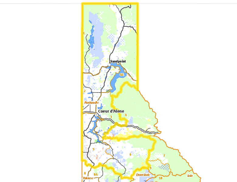
Surface Management
For government land, these data show the managing agency of the land, which may or not be the same as the owning agency.
 Private 43.82%
|
|
U.S. Forest Service (USFS) 38.24%
|
|
State of Idaho 10.59%
|
|
Other 4.47%
|
|
Indian Reservation / Bureau of Indian Affairs 1.67%
|
|
U.S. Bureau of Land Management (BLM) 1.19%
|
Make your own map of Hunt Area
Ownership data source: Inside Idaho
Access Yes! Properties
Access Yes! is Fish and Game program designed to improve hunting and fishing access to private land or through private land to public land by compensating willing landowners who provide access.
Forest Service Land
Check for road and area closures on National Forest websites
- Clearwater National Forest
- Coeur d'Alene National Forest
- Kaniksu National Forest
- Kootenai National Forest
- St. Joe National Forest
Federally-designated Wilderness Areas
No motorized vehicles are allowed in these areas.
There are no wilderness areas in .
Land Use/Land Cover
|
Forest
69.62
%
|
|
Dryland Agriculture
19.96
%
|
|
Rangeland
4.88
%
|
|
Water
4.09
%
|
|
Urban
0.76
%
|
|
Riparian
0.67
%
|
Make your own map of Hunt Area
Land Use data source: IDWR
Towns in this Hunt Area
- Coeur d'Alene, US 95 Interstate 90
- Post Falls, Interstate 90
- Sandpoint, US 95 US 2 Idaho 200
- Rathdrum, Idaho 53
- Bonners Ferry, US 95
- St. Maries, Idaho 3
- Cataldo, Interstate 90
- Priest River, Idaho 57 US 2
- Spirit Lake, Idaho 41
- Plummer, US 95
- Athol, US 95 Interstate 90
- Hope / Clark Fork, Idaho 200
- Priest Lake, Idaho 57
- Harrison, Idaho 97
- Worley, US 95
- Bayview, US 95
- Blanchard, Idaho 41