Idaho Hunt Planner We got game.
Hunt Area
On and within one mile of private land in all of Unit 3. On and within one mile of private lands in those portions of Units 4 and 6 within the following boundary: beginning at the Cataldo Exit off Interstate 90, then south along Latour Creek Road to Forest Service Road 613 to St Joe Baldy, then south on Philips Draw Road to the St Joe River, then west on the St Joe River to Mission Point on State Highway 3, then northeast on State Highway 3 to Interstate 90 to point of beginning.
More information about the Game Management Unit(s) in this area: 3 4 6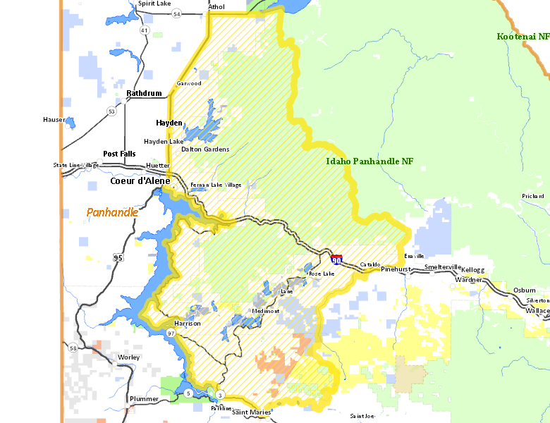
Surface Management
For government land, these data show the managing agency of the land, which may or not be the same as the owning agency.
 Private 46.72%
|
|
U.S. Forest Service (USFS) 42.9%
|
|
State of Idaho 4.43%
|
|
U.S. Bureau of Land Management (BLM) 2.22%
|
|
Other 2.12%
|
|
Indian Reservation / Bureau of Indian Affairs 1.61%
|
Make your own map of Hunt Area
Ownership data source: Inside Idaho
Access Yes! Properties
Access Yes! is Fish and Game program designed to improve hunting and fishing access to private land or through private land to public land by compensating willing landowners who provide access.
No properties are currently available in .
View all Access Yes Participants.
Forest Service Land
Check for road and area closures on National Forest websites
Federally-designated Wilderness Areas
No motorized vehicles are allowed in these areas.
There are no wilderness areas in .
Land Use/Land Cover
No landcover for this area is available at this time.
Towns in this Hunt Area
- Coeur d'Alene, US 95 Interstate 90
- St. Maries, Idaho 3
- Cataldo, Interstate 90
- Athol, US 95 Interstate 90
- Harrison, Idaho 97