Idaho Hunt Planner We got game.
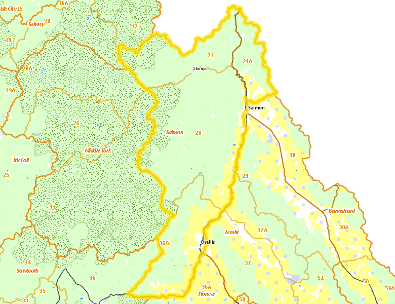
Salmon Zone
Units 21, 21A, 28, 36B
More information about GMU(s) in Salmon Zone :
Public Access
Land Ownership
| U.S. Forest Service (USFS) |  82.58
%
82.58
%
|
| U.S. Bureau of Land Management (BLM) |
12.39
%
|
| Private |
4.44
%
|
| State of Idaho |
0.35
%
|
| Other |
0.21
%
|
Make your own map of Salmon Zone
Ownership data source: Inside Idaho
Access Yes! Properties
No properties are currently available in Salmon Zone.
View all Access Yes Participants.
National Forests
Federally-designated Wilderness Areas
-
Frank Church - River of No Return Wilderness
188,050 acres (11.08% of hunt area)
Land Use/Cover
| Forest |
80.03
%
|
| Rangeland |
17.2
%
|
| Irrigated-Gravity Flow |
1.72
%
|
| Irrigated-Sprinkler |
0.79
%
|
| Riparian |
0.18
%
|
| Urban |
0.04
%
|
| Water |
0.01
%
|
Make your own map of Salmon Zone
Land Use data source: IDWR
Services
Lodging, Camping & Services in Salmon Zone
- North Fork, US 93
- Salmon, US 93
- Challis, US 93
* Services pages courtesy of the Official Idaho Travel and Tourism Guide