Idaho Hunt Planner We got game.
Hunt Area
Those portions of Units 74 and 75 within the following: Beginning at the junction of Highway 34 and Central Road, west on Central Road to Mountain Road, south on Mountain Road to Gentile Road, south on Gentile Road to River Road, south on River Road to Thatcher Road, east on Thatcher Road to Highway 34, south on Highway 34 to Main Canyon Road (USFS Road 440) to the USFS boundary, north along the USFS boundary to King Canyon Road (USFS Road 183), west on King Canyon Road to the Harwood Road, south on Harwood Road to Burton Road, west on Burton Road to Highway 34 to the point of beginning.
More information about the Game Management Unit(s) in this area: 74 75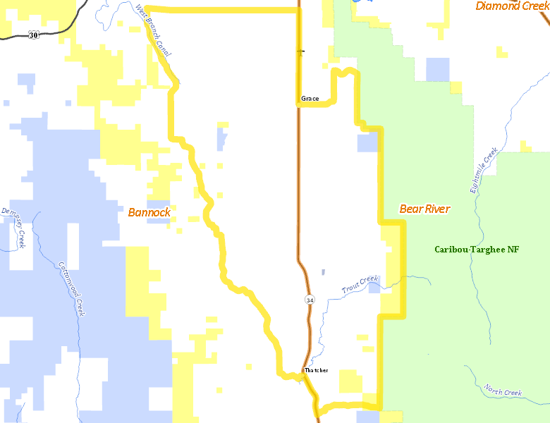
Surface Management
For government land, these data show the managing agency of the land, which may or not be the same as the owning agency.
 Private 93.8%
|
|
U.S. Bureau of Land Management (BLM) 4.75%
|
|
State of Idaho 1.44%
|
|
U.S. Forest Service (USFS) 0.01%
|
Make your own map of Hunt Area
Ownership data source: Inside Idaho
Access Yes! Properties
Access Yes! is Fish and Game program designed to improve hunting and fishing access to private land or through private land to public land by compensating willing landowners who provide access.
No properties are currently available in .
View all Access Yes Participants.
Forest Service Land
Check for road and area closures on National Forest websites
No National Forest lands fall within .
Federally-designated Wilderness Areas
No motorized vehicles are allowed in these areas.
There are no wilderness areas in .
Land Use/Land Cover
|
Irrigated-Sprinkler
66.05
%
|
|
Rangeland
14.93
%
|
|
Urban
11.78
%
|
|
Dryland Agriculture
5.85
%
|
|
Irrigated-Gravity Flow
0.95
%
|
|
Forest
0.45
%
|
Make your own map of Hunt Area
Land Use data source: IDWR
Towns in this Hunt Area
- Grace, Idaho 34