Idaho Hunt Planner We got game.
Hunt Area
That portion of Unit 39 within the following boundary: Beginning at a point 400 yards north of State Highway 21 at the Ada County Line, south and west on a line 400 yards north of State Highway 21 to Warm Springs Avenue, and west on a line 400 yards north of Warm Springs Avenue to the Highlands-Table Rock powerline, north and west on the Highlands-Table Rock powerline to State Highway 55, north on Highway 55 to the Ada County Line, and southeast on the Ada County Line to the point of beginning; AND that portion of Unit 39 within the following boundary: Beginning at the intersection of State Highway 21 and the Middle Fork Boise River Road (Forest Road 268), east on FR 268 to Cottonwood Creek-Thorn Creek Road (FR 377), north and west on FR 377 to State Highway 21, south and west on Highway 21 to the point of beginning.
More information about the Game Management Unit(s) in this area: 39 39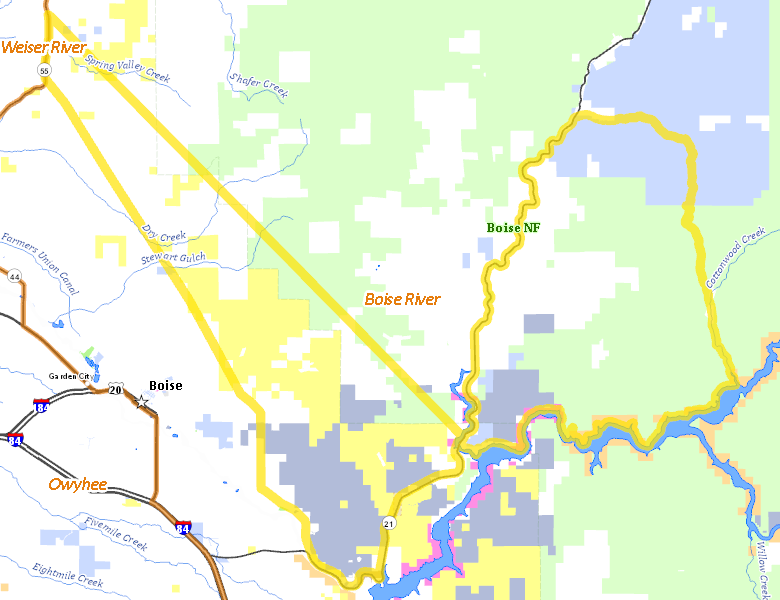
Surface Management
For government land, these data show the managing agency of the land, which may or not be the same as the owning agency.
 Private 33.04%
|
|
U.S. Forest Service (USFS) 29.5%
|
|
State of Idaho 20.7%
|
|
U.S. Bureau of Land Management (BLM) 15.54%
|
|
U.S. Bureau of Reclamation (BOR) 0.78%
|
|
U.S. Military 0.38%
|
|
U.S. Corps of Engineers (COE) 0.04%
|
|
Other 0.01%
|
Make your own map of Hunt Area
Ownership data source: Inside Idaho
Access Yes! Properties
Access Yes! is Fish and Game program designed to improve hunting and fishing access to private land or through private land to public land by compensating willing landowners who provide access.
No properties are currently available in .
View all Access Yes Participants.
Forest Service Land
Check for road and area closures on National Forest websites
Federally-designated Wilderness Areas
No motorized vehicles are allowed in these areas.
There are no wilderness areas in .
Land Use/Land Cover
|
Rangeland
59.17
%
|
|
Forest
40.24
%
|
|
Irrigated-Gravity Flow
0.39
%
|
|
Water
0.2
%
|
Make your own map of Hunt Area
Land Use data source: IDWR
Towns in this Hunt Area
No services are available inside .
Services courtesy of the Official Idaho Travel and Tourism Guide