Idaho Hunt Planner We got game.
Hunt Area
That portion of Unit 22 that lies outside National Forest System Boundary and drains into the Weiser River, upstream from and including the Pine Creek drainage and downstream from and including the West Fork Weiser River drainage but excluding the entire Lost Creek Drainage. That portion of Unit 32A that lies outside National Forest System Boundary and drains into the Weiser River upstream from and including the Middle Fork Weiser River drainage and downstream from but excluding the East Fork Weiser River drainage. The National Forest System Boundary is a legislatively set boundary - it is not necessarily the boundary of Forest Service property. State, private, and other lands within the National Forest System Boundary are not open to hunting during this season. (Please refer to a U.S. Forest Service map for the location of this boundary.)
More information about the Game Management Unit(s) in this area: 22 32A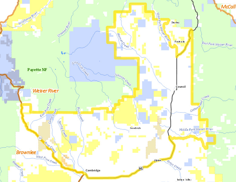
Surface Management
For government land, these data show the managing agency of the land, which may or not be the same as the owning agency.
 Private 76.52%
|
|
U.S. Bureau of Land Management (BLM) 15.78%
|
|
State of Idaho 7.33%
|
|
U.S. Bureau of Reclamation (BOR) 0.35%
|
|
U.S. Forest Service (USFS) 0.02%
|
Make your own map of Hunt Area
Ownership data source: Inside Idaho
Access Yes! Properties
Access Yes! is Fish and Game program designed to improve hunting and fishing access to private land or through private land to public land by compensating willing landowners who provide access.
No properties are currently available in .
View all Access Yes Participants.
Forest Service Land
Check for road and area closures on National Forest websites
No National Forest lands fall within .
Federally-designated Wilderness Areas
No motorized vehicles are allowed in these areas.
There are no wilderness areas in .
Land Use/Land Cover
No landcover for this area is available at this time.