Idaho Hunt Planner We got game.
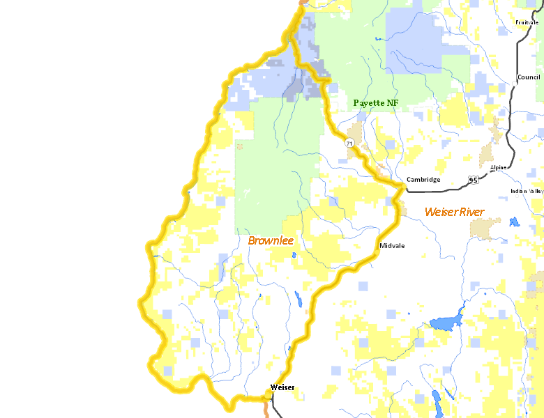
Brownlee Zone
Unit 31
More information about GMU(s) in Brownlee Zone :
Public Access
Land Ownership
| Private |  49.59
%
49.59
%
|
| U.S. Bureau of Land Management (BLM) |
23.12
%
|
| U.S. Forest Service (USFS) |
18.72
%
|
| State of Idaho |
7.51
%
|
| U.S. Bureau of Reclamation (BOR) |
0.02
%
|
| U.S. National Wildlife Refuge (NWR) |
0.01
%
|
| Other |
0.01
%
|
Make your own map of Brownlee Zone
Ownership data source: Inside Idaho
Access Yes! Properties
National Forests
Federally-designated Wilderness Areas
There are no wilderness areas in Brownlee Zone.
Land Use/Cover
| Rangeland |
73.64
%
|
| Forest |
19.25
%
|
| Irrigated-Gravity Flow |
5.75
%
|
| Irrigated-Sprinkler |
0.77
%
|
| Water |
0.33
%
|
| Urban |
0.21
%
|
Make your own map of Brownlee Zone
Land Use data source: IDWR
Services
Lodging, Camping & Services in Brownlee Zone
* Services pages courtesy of the Official Idaho Travel and Tourism Guide