Idaho Hunt Planner We got game.
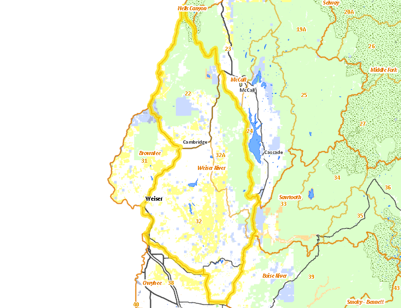
Weiser River Zone
Units 22, 32, 32A
More information about GMU(s) in Weiser River Zone :
Hunting Opportunities in Weiser River Zone
Public Access
Land Ownership
| Private |  48.95
%
48.95
%
|
| U.S. Forest Service (USFS) |
28.5
%
|
| U.S. Bureau of Land Management (BLM) |
15.33
%
|
| State of Idaho |
6.56
%
|
| U.S. Bureau of Reclamation (BOR) |
0.31
%
|
| Other |
0.21
%
|
| U.S. National Wildlife Refuge (NWR) |
0.01
%
|
Make your own map of Weiser River Zone
Ownership data source: Inside Idaho
Access Yes! Properties
National Forests
Federally-designated Wilderness Areas
-
Hells Canyon Wilderness
18,175 acres (0.98% of hunt area)
Land Use/Cover
| Rangeland |
59.28
%
|
| Forest |
32.32
%
|
| Irrigated-Gravity Flow |
5.82
%
|
| Irrigated-Sprinkler |
1.71
%
|
| Urban |
0.34
%
|
| Water |
0.27
%
|
| Dryland Agriculture |
0.15
%
|
| Riparian |
0.1
%
|
Make your own map of Weiser River Zone
Land Use data source: IDWR
Services
Lodging, Camping & Services in Weiser River Zone
- Payette, US 95 Idaho 52
- Emmett, Idaho 52
- Weiser, US 95
- Horseshoe Bend, Idaho 55 Idaho 52
- Council, US 95
- Cambridge, US 95
* Services pages courtesy of the Official Idaho Travel and Tourism Guide