Turn Layers On/Off
TURN LAYERS ON/OFF
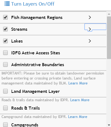
Toggle a layer on/off in the Turn Layers On/Off window by checking/unchecking the checkbox in front of its layer name.
Increase/decrease layer transparency using the slider at the top of each layer group. This is especially useful for the Land Management Layer; it is currently set at 50% transparency so you can see other layers and the basemap under it.
The fishing and boating access sites, campgrounds and wildfire layers have Popup Information Boxes enable. When these layers are turned on, click on a feature to get more information about it.
Layer Descriptions:
- Fishing & Boating Access Sites: Location and facilities information for Fishing and Boating Access Sites managed or co-managed by the Idaho Department of Fish and Game.
For more information about the Fisheries Data and Applications: https://fishandgame.idaho.gov/ifwis/portal/fisheries
- Administrative Boundaries: created by IDFG, BLM, and USFS. Useful layers for navigation and context.
For more information about Wildlife Management Areas: http://fishandgame.idaho.gov/public/wildlife/wma/
WMA desktop interactive map application: http://fishandgame.idaho.gov/ifwis/maps/wma/
National Forest Administrative Boundaries: The lands administered by a USFS administrative unit. The area encompasses private lands, other governmental agency lands, and may contain NF lands within the proclaimed boundaries of another administrative unit. All NF lands fall within one and only one administrative forest area. http://data.fs.usda.gov/geodata/edw/edw_resources/meta/S_USA.AdministrativeForest.xml
- FAA Airports/Airstrips: created by the Federal Aviation Administration. Click on an airport to get more information. More Information
- Campgrounds: created by Idaho Dept. of Parks and Recreation. Idaho campgrounds and RV parks as of 12/9/13. Click on a campground to get a popup box with information such as phone number, fees, # of Sites, who administers the site, etc. Map Service URL
- Roads & Trail Closures: created by Idaho Dept. of Parks and Recreation. Public road and trail closures due to flooding, winter run-off damage, wildfires, etc. Map Service URL
- Roads & Trails: created by Idaho Dept. of Parks and Recreation using USFS Motor Vehicle Use Map and BLM Road data. NOTE: If these layers is grayed-out, it has a scale-dependency set on it and you need to zoom in until it becomes active. If you would like to see more information about a specific road/trail, use the Idaho Trails Map (http://www.trails.idaho.gov/trails/).
- USFS Motor Vehicle Use: created by the US Forest Service. It reflects travel management decisions for each Forest. Displays routes designated as open to motorized travel. More information
- Land Cover Layer: created by the Multi-Resolution Land Characteristics Consortium (MRLC). MRLC is a group of federal agencies who coordinate and generate consistent and relevant land cover information at the national scale for a wide variety of environmental, land management, and modeling applications. The creation of the consortium has resulted in the mapping of the lower 48 United States, Hawaii, Alaska, and Puerto Rico into a comprehensive land cover product termed, the National Land Cover Database (NLCD), from decadal Landsat imagery and other supplementary datasets. More Information
- IDL Endowment Lands Layer: created by Idaho Department of Lands. This layer shows lands designated as Yes or No public access. Yes: these lands can be accessed by foot or water. Some lands may have motorized access. No: these lands are not accessible because they are surrounded by private landowners or because activities occurring on the lands make them unsafe for the public, such as within a military training area. More Information
- State & Federal Land Management Layer: created by BLM. This layer displays the managing agency, not owner, of the surface of the land. This Surface Management Agency GIS dataset is not a legal document and should be used as a general guide only. Metadata
- Wildfire & Closure Related Layers:
- South Pioneer Fire Recovery Project Area (USFS Order # 0402-00-53): created by the USFS Boise National Forest. Depicts an area that is closed to public entry because of a salvage logging operation in the area of the 2016 Pioneer Fire in central Idaho north of Idaho City. https://www.fs.usda.gov/detail/boise/news-events/?cid=FSEPRD555239
- Fire Emergency Closure Areas: created by IDFG. Support from USFS Boise National Forest.
- Active Fire Report: created by esri. General location of active wildfires in the US. https://idfggis.maps.arcgis.com/home/item.html?id=4d63f7de557c4a69bab44c376c0d3565
- Fire Perimeters and MODIS fire detections: created by GeoMAC (Geospatial Multi-Agency Coordination) Wildland Fire Support. http://www.geomac.gov/ and USFS-RSAC (Remote Sensing Application Center. https://fsapps.nwcg.gov/afm/
- Wilks Development - Limited Access: created by IDFG from Adams, Boise, and Valley county parcel data. http://www.idahocountyfreepress.com/news/2017/apr/05/wilks-ranch-now-largest-single-landowner-idaho-cou/
Created with the Personal Edition of HelpNDoc: Create help files for the Qt Help Framework