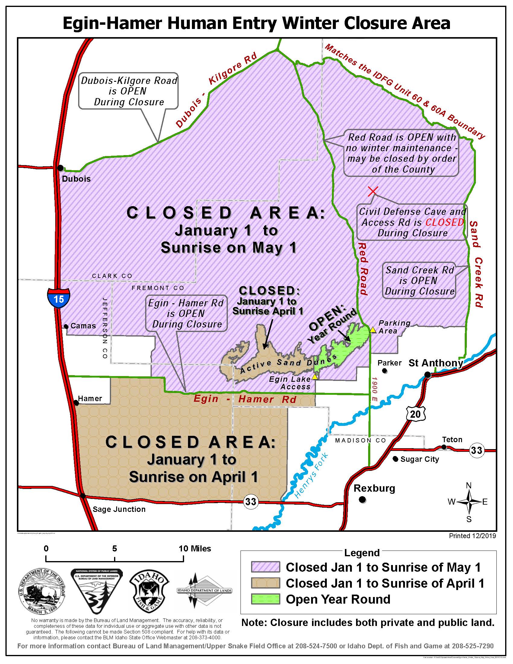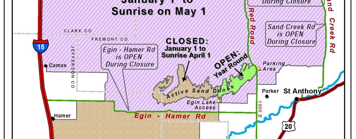
The Egin-Hamer Area Closure places nearly 500 square miles of BLM land off-limits to human entry for the protection of wintering deer, elk and moose. The closure begins on Jan. 1 and lasts until sunrise on April 1 south of the Egin-Hamer Road and until sunrise on May 1 north of it.
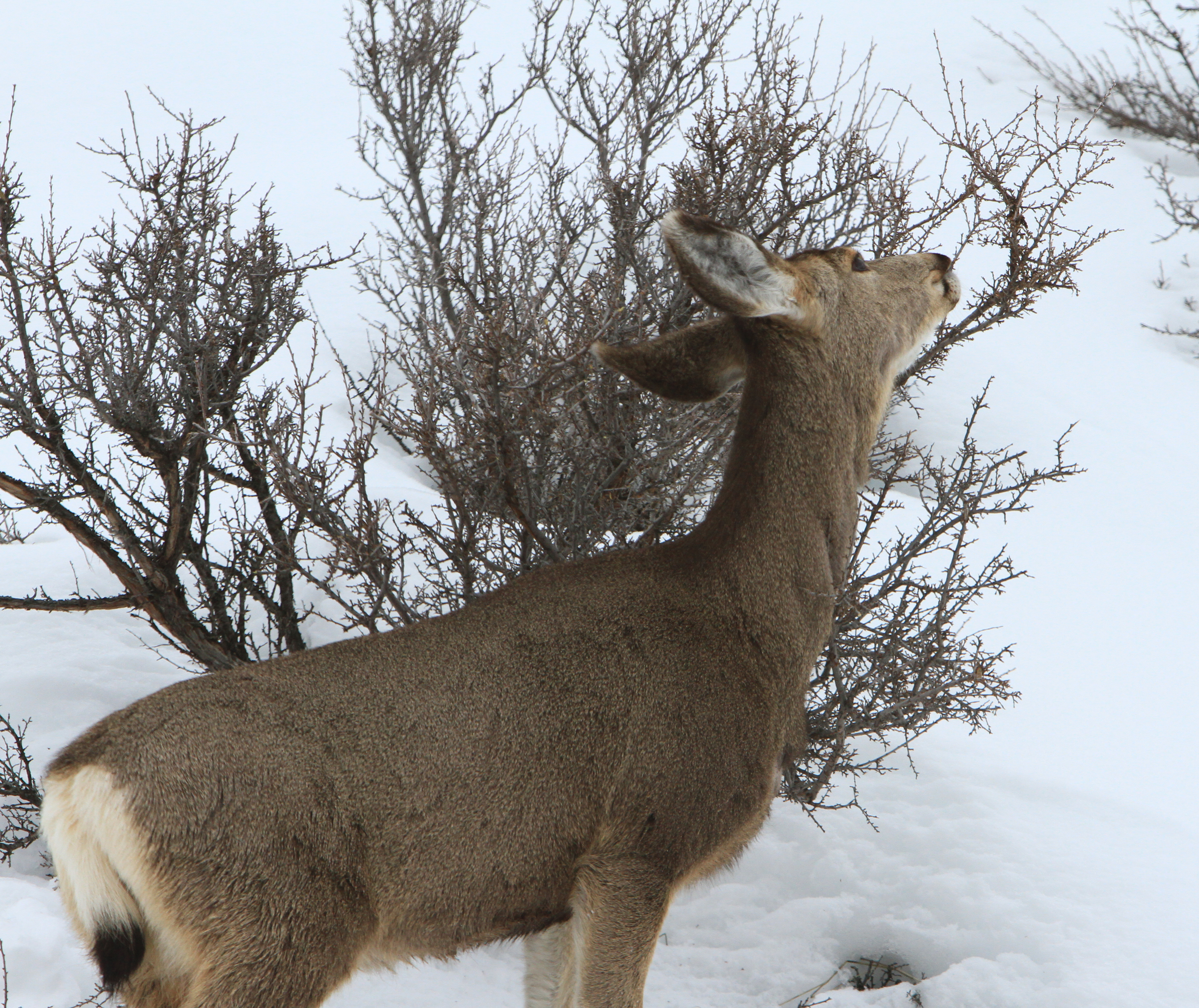
The absence of human disturbance created by the closure allows herds of deer, elk, and moose to spend more time down on the desert between St. Anthony and Dubois during crucial portions of the late winter and early spring.
Landowners accessing their private lands are exempt from the closure and the active sand dunes from the Red Road to Thunder Mountain and adjacent to Egin Lakes access remain open.
Occasionally powered parachutes, helicopters, and small planes have been sighted flying low over the closure area. While the air space over the closure is not restricted, pilots of all types are cautioned to not harass the wintering, deer, elk and moose. If the machines are flying low enough to cause the wildlife to move away, then they are flying too low.